THE RUNAWAY BLIMP NEAR MUNCY PA...: image by Carl McDaniel, 29 October 2014
Unsnack your snood, madonna, for the stars
Are shining on all brows of Neversink.
Already the green bird of summer has flown
Away. The night-flies acknowledge these planets,
Predestined to this night, this noise and the place
Of summer. Tomorrow will look like today,
Will appear like it. But it will be an appearance,
A shape left behind, with like wings spreading out,
Brightly empowered with like colors, swarmingly,
But not quite molten, not quite the fluid thing,
A little changed by tips of artifice, changed
By the glints of sound from the grass. These are not
The early constellations, from which came the first
Illustrious intimations -- uncertain love,
The knowledge of being, sense without sense of time.
Take the diamonds from your hair and lay them down.
The deer-grass is thin. The timothy is brown.
The shadow of an external world comes near.
Wallace Stevens (1879-1955): Late Hymn from the Myrrh-Mountain, 1946, from Transport to Summer, 1947
The runaway military #blimp went down near Moreland Township, Pennsylvania, and it looked like this: image via Mashable Verified account @mashable, 28 October 2015

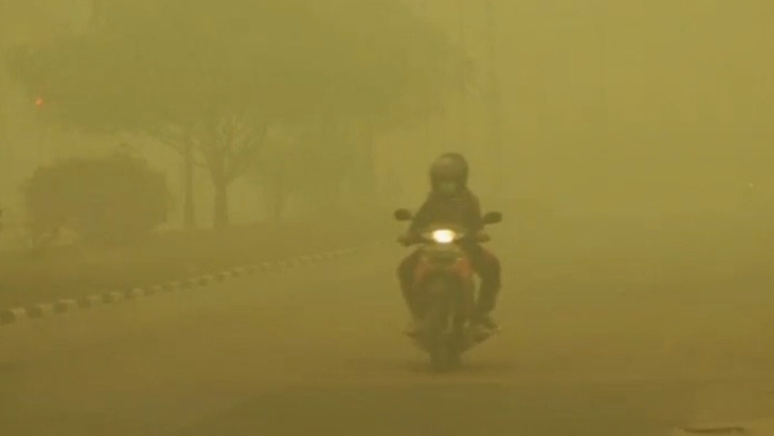
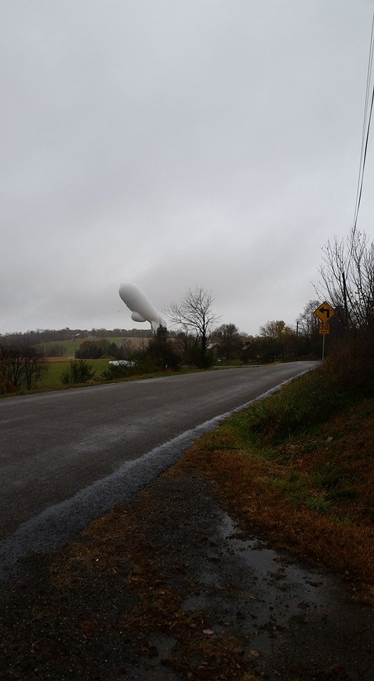
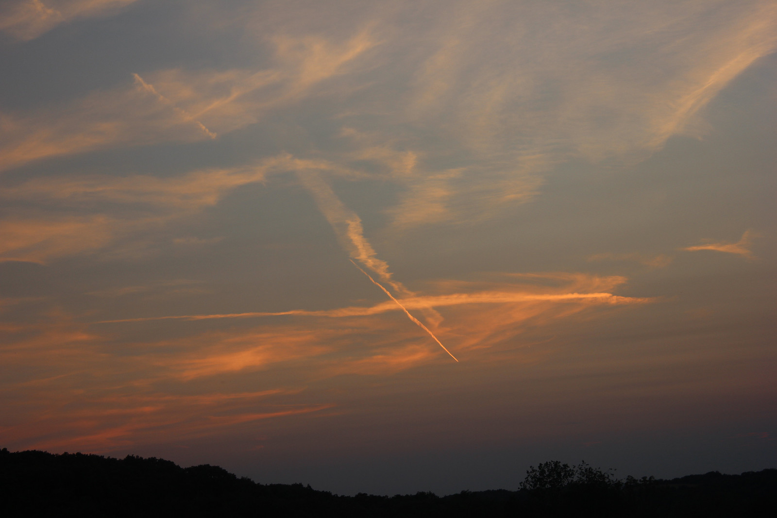
More Frightening Than Halloween. Every day I seem to notice more of these objects in the sky. Big Brother protecting us or is something sinister happening here?: photo by mcnod, 26 October 2015
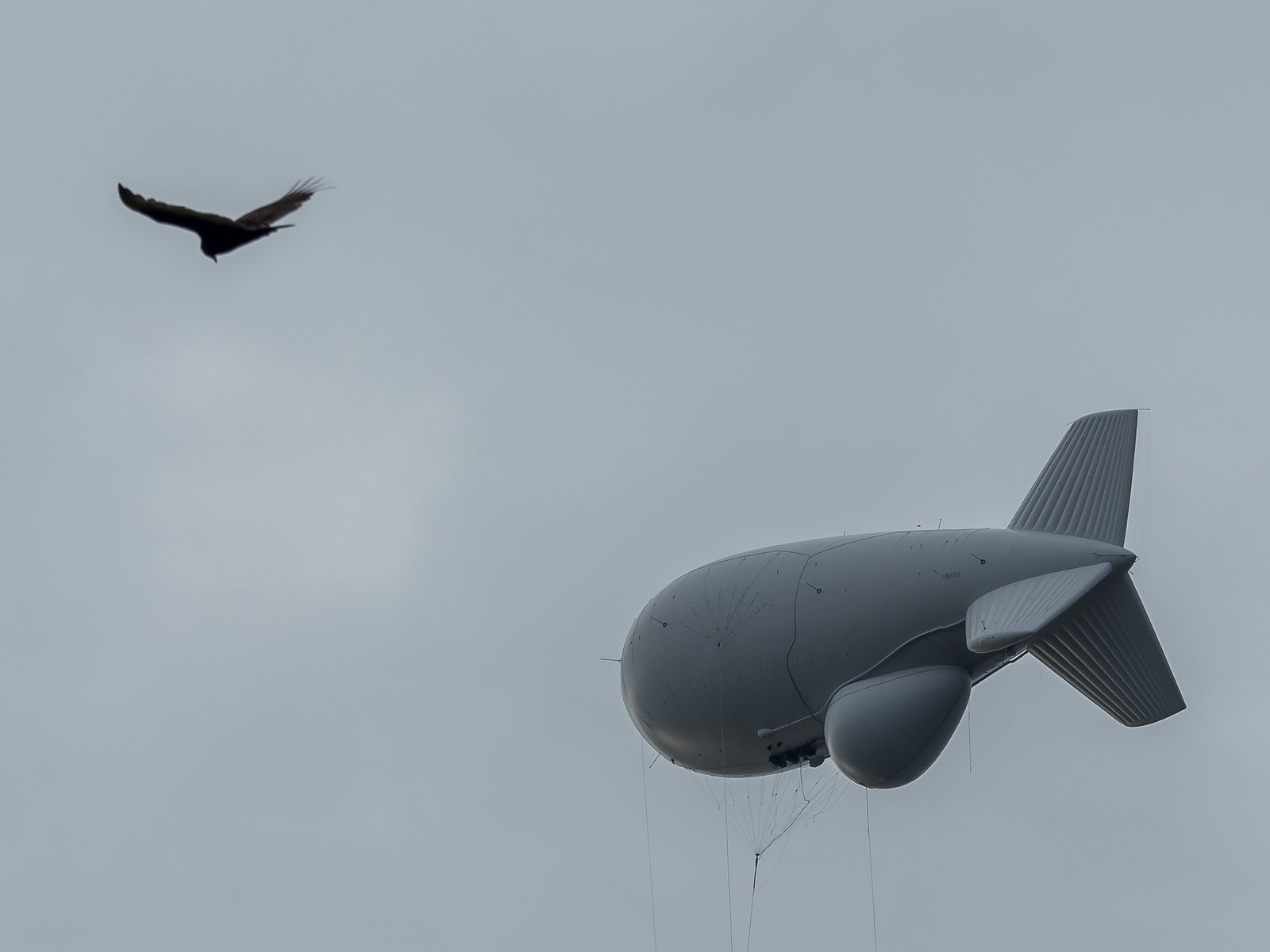
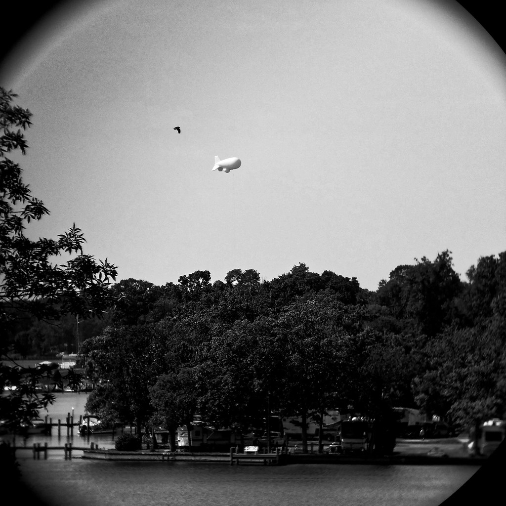
365: Day 238: Aerostat-ic. Phone camera loooking through binoculars (so technically monocular) [Belcamp, Maryland]: photo by Rob Clatterbuck, 28 August 2015
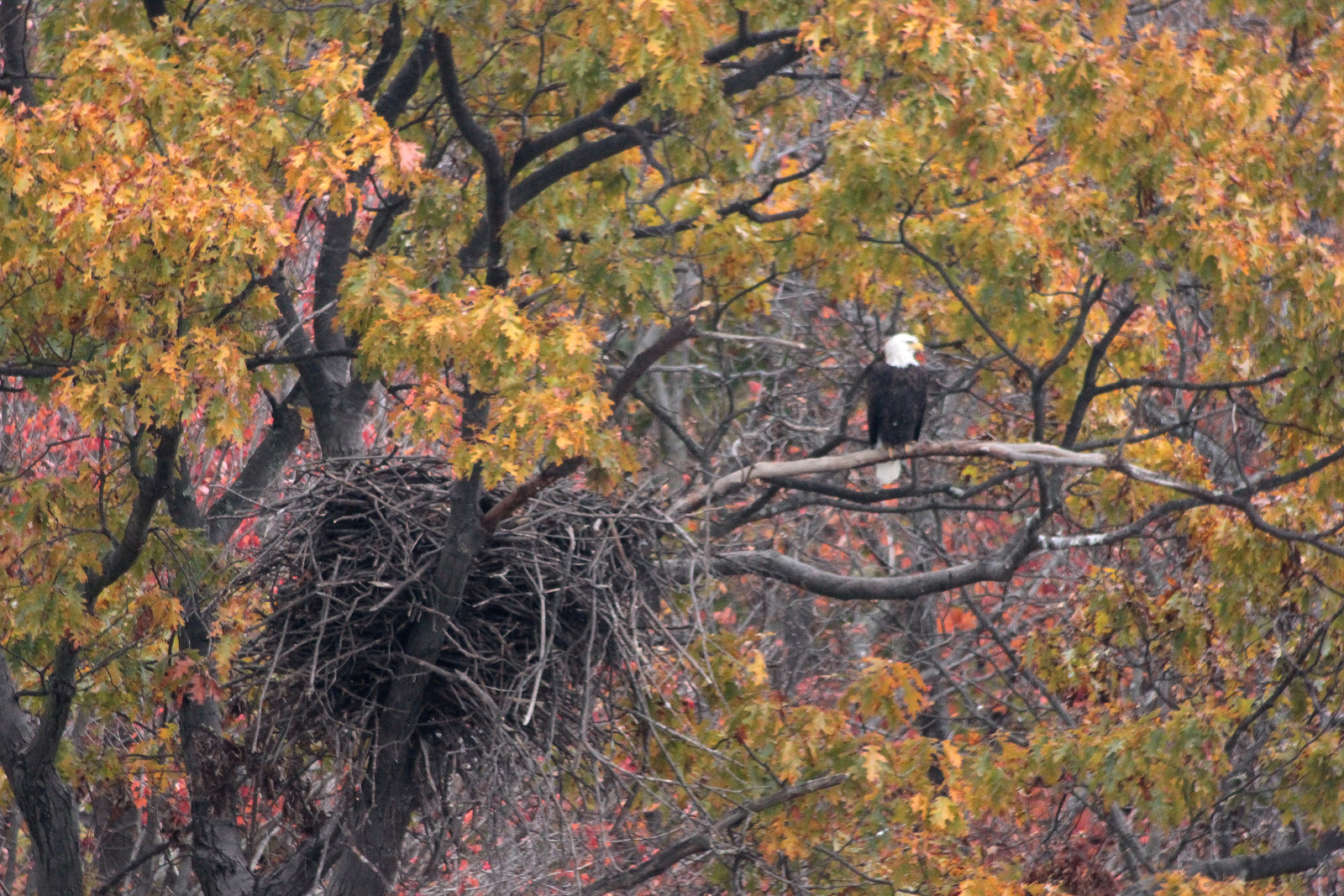
Bald eagle and eyrie. Montour Preserve at Lake Chillisquaqua. Near Exchange, Pennsylvania.: photo by fishhawk, 24 October 2015
Eudora Welty: Place

Place can be transparent, or translucent: not people. In real life we have to express the things plainest and closest to our minds by the clumsy word and the half-finished
gesture; the chances are our most usual behavior makes sense only in a kind of daily way, because it has become familiar to our nearest and dearest, and still demands
their constant indulgence and understanding. It is our describable outside that defines us, willy-nilly, to others; that may save us, or destroy us, in the world; it may be
our shield against chaos, our mask against exposure; but whatever it is, the move we make in the place we live has to signify our intent and meaning.
*
Surely place induces poetry, and when the poet is extremely attentive to what is there, a meaning may even attach to his poem out of the spot on earth where it is
spoken, and the poem signify the more because it does spring so wholly out of its place, and the sap has run up into it as into a tree.
*
There may come to be new places in our lives that are second spiritual homes closer to us in some ways, perhaps, than our original homes. But the home tie is the blood
tie. And had it meant nothing to us, any other place thereafter would have meant less, and we would carry no compass inside ourselves to find home ever, anywhere at
all. We would not even guess what we had missed.

Eudora Welty (1909-2001): from Place in Fiction, in The Eye of The Story and Other Essays, 1959
BLIMP DOWN: State Police report #blimp is down in Montour county near Muncy. We got this photo from viewer there.: image via John Meyer Verified account @JohnMeyerWNEP, 28 October 2015

Favorites today, #blimplivesmatter, and headline 'Fled Zeppelin.' photo by Carrie Littlewood: image via Michael K. Dakota @DakotaLDN, 28 October 2015

#foundblimp #bloomsburg #blimp shot by Susan Switzer & Rhame Eyer @LDNews: image via Michael K. Dakota @DakotaLDN, 28 October 2015

#foundblimp #bloomsburg #blimp shot by Susan Switzer & Rhame Eyer @LDNews: image via Michael K. Dakota @DakotaLDN, 28 October 2015

#blimp #BlimpOnTheLoose #BlimpLife #looseblimp She's down in #Millsville: image via Michael K. Dakota @DakotaLDN, 28 October 2015
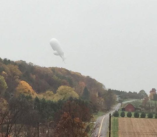
Another photo of what is believed to be the #blimp via Holly Starr near Bloomsburg, PA: image via CampusWeatherService @PSUWeather, 28 October 2015 State College, PA

A viewer just sent us this photo from Bloomsburg. We are getting numerous reports of sightings in that area. #Blimp: image via John Meyer Verified account @JohnMeyerWNEP, 28 October 2015
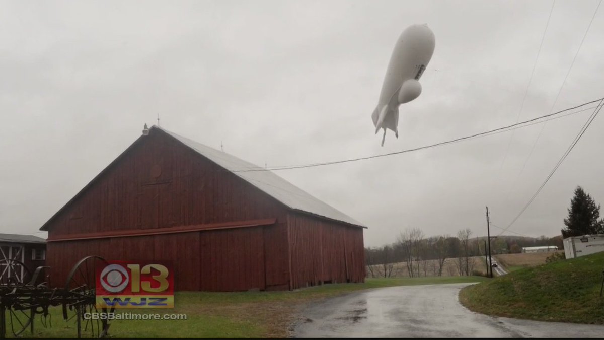
State Police used shotguns to deflate #blimpontheloose #blimp: image via WJZ / CBS Baltimore Verified account @cbsbaltimore, 28 October 2015
Runaway U.S. military blimp wreaks havoc in Pennsylvania: image via Reuters Top News @Reuters, 28 October 2015
Runaway U.S. military blimp wreaks havoc in Pennsylvania: Joe McDonald and Phil Stewart, Reuters, 28 October 2015 (updated 29 October 2015)
A high-tech U.S. military blimp designed to detect a
missile attack came loose on Wednesday and wreaked havoc as it floated
from Maryland into Pennsylvania while dragging more than a mile of cable
and knocking out power to thousands.
The U.S. military scrambled two armed F-16 fighter jets to keep watch as the massive blimp traveled into civilian airspace after coming untethered from its base at Aberdeen Proving Ground, a U.S. Army facility 40 miles (65 km) northeast of Baltimore.
Pentagon officials said they were unsure why the 242-foot-long blimp broke free at 12:20 p.m. Military officials wrestled for hours over the best way to bring it down safely, but eventually it deflated on its own.

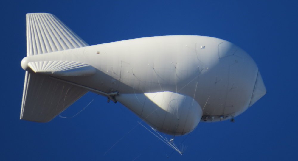
Technically speaking, JLENS is an aerostat, which means tethered airship. It’s anchored to the ground by a 11/8 inch thick super-strong cable. The tether is strong enough to withstand 100 mph winds… and during testing, it accidentally was exposed to a 106 mph storm and did just fine. Electricity runs up the cable and powers JLENS’ radar, and ones-and-zeroes from the radar run down fiber optic wires to a computer processing station on the ground. In fact, a lot of the things which makes JLENS work are on the ground… including the people who operate the system: photo via Raytheon, 2015
The blimp, part of a $2.8 billion Army program, landed in a rural, wooded area in Exchange, Pennsylvania, a community outside Bloomsburg, about 150 miles (240 km) north of the Aberdeen Proving Ground.
John Thomas, a spokesman for Columbia County emergency management agency, said there were no reports of injuries but had no more details about the landing.
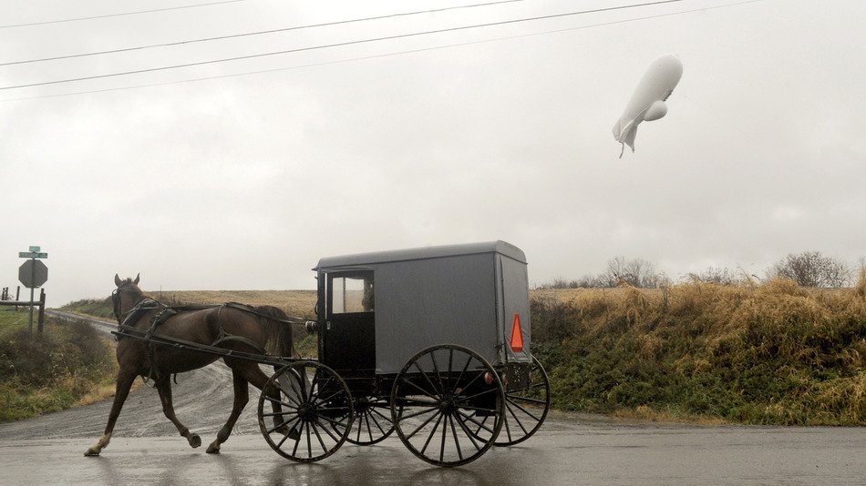
Pennsylvania police and military officials guarded a wide safety perimeter around the blimp, which settled amid farmland in the remote area. Residents, including members of an Amish community, watched them work under steady rainfall.

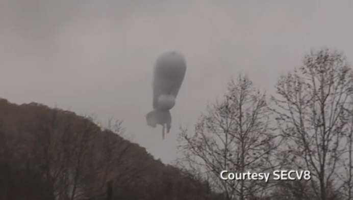
A high-tech U.S. military blimp designed to detect a missile attack is pictured coming to the ground in Montour County, Pennsylvania: photo via Reuters/SECV8, a segment of Service Electric Cablevision, 28 October 2015
The blimp's travels
caused widespread damage, officials said. At one point, 30,000
Pennsylvania residents were without power, the governor's office said.
"The tether attached to the aircraft caused widespread power outages across Pennsylvania," said a statement from Governor Tom Wolf's office.

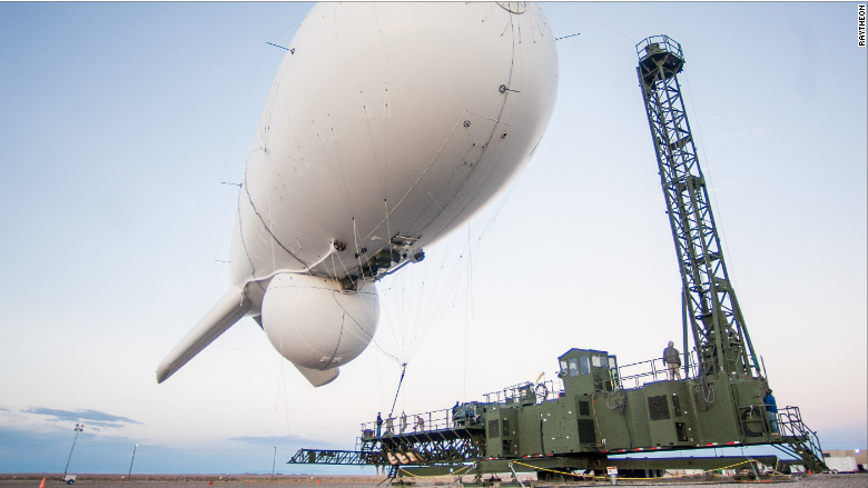
JLENS doesn’t have any weapons, so if it detects an inbound threat like a cruise missile or drone, it will pass that information on to the National Capital Region’s Integrated Air Defense System. Another cool feature is that JLENS works with other air defense systems, like the AMRAAM air-to-air missile, the U.S. Navy’s Standard Missile-6, the U.S. Army’s Patriot air defense system and the National Advanced Surface to Air Missile System, which is currently defending the Washington, D.C. area.: photo via Raytheon, 2015
The blimp's travels were a sensation on social media, with hashtags like #Blimpflood and #Blimpmemes ranking among the top trending topics. At least two Twitter parody accounts sprung up, gaining nearly 2,000 followers in just under two hours.
The attention was unlikely to be welcomed by the Army, which calls the program the Joint Land-Attack Cruise Missile Elevated Netted Sensor System, or JLENS. The program was restructured after it overran cost estimates, the Government Accountability Office said in 2014.

JLENS by jay ta.: photo by total annihilation, 4 November 2006
The program is comprised of two blimps, each 242 feet long. The second blimp will be grounded until the military inspects it and finishes an investigation into the unmooring, said Navy Captain Scott Miller, a spokesman for the U.S. military's North American Aerospace Defense Command, or NORAD.
The system itself is still in a testing phase. Manufacturer Raytheon Co's website says it would become part of the defenses that help protect the metropolitan Washington, D.C., area.

There’s a good reason senior military leaders are concerned about cruise missiles. They fly low, making them really hard for a ground-based radar to spot; there are lots of them out there; and some of them can even be launched from innocent-looking cargo containers.
Cruise missile defense is literally JLENS’s middle name. When the system is operational at Aberdeen Proving Ground, it will become part of the defenses that help protect the National Capital Region -- the federal government's name for the metro Washington, D.C. area.: photo via Raytheon, 2015
Raytheon's website says the blimps are meant to be tethered to the ground by a "11/8 inch thick super-strong cable," which should withstand 100 mile-per-hour (160 kph) winds. Electricity runs up the cable and powers the radar, the website says.
NORAD said the blimp became untethered while at an altitude of 6,600 feet, far below its maximum recommended altitude of up to 10,000 feet.
By early afternoon, it had climbed to 16,000 feet as it traveled into Pennsylvania.
NORAD said the system was designed to defend against threats beyond cruise missiles, to include drone aircraft and "surface moving targets" such as swarming boats and tanks.
The U.S. military scrambled two armed F-16 fighter jets to keep watch as the massive blimp traveled into civilian airspace after coming untethered from its base at Aberdeen Proving Ground, a U.S. Army facility 40 miles (65 km) northeast of Baltimore.
Pentagon officials said they were unsure why the 242-foot-long blimp broke free at 12:20 p.m. Military officials wrestled for hours over the best way to bring it down safely, but eventually it deflated on its own.
Technically speaking, JLENS is an aerostat, which means tethered airship. It’s anchored to the ground by a 11/8 inch thick super-strong cable. The tether is strong enough to withstand 100 mph winds… and during testing, it accidentally was exposed to a 106 mph storm and did just fine. Electricity runs up the cable and powers JLENS’ radar, and ones-and-zeroes from the radar run down fiber optic wires to a computer processing station on the ground. In fact, a lot of the things which makes JLENS work are on the ground… including the people who operate the system: photo via Raytheon, 2015
The blimp, part of a $2.8 billion Army program, landed in a rural, wooded area in Exchange, Pennsylvania, a community outside Bloomsburg, about 150 miles (240 km) north of the Aberdeen Proving Ground.
John Thomas, a spokesman for Columbia County emergency management agency, said there were no reports of injuries but had no more details about the landing.
Pennsylvania police and military officials guarded a wide safety perimeter around the blimp, which settled amid farmland in the remote area. Residents, including members of an Amish community, watched them work under steady rainfall.
A high-tech U.S. military blimp designed to detect a missile attack is pictured coming to the ground in Montour County, Pennsylvania: photo via Reuters/SECV8, a segment of Service Electric Cablevision, 28 October 2015
"The tether attached to the aircraft caused widespread power outages across Pennsylvania," said a statement from Governor Tom Wolf's office.
JLENS doesn’t have any weapons, so if it detects an inbound threat like a cruise missile or drone, it will pass that information on to the National Capital Region’s Integrated Air Defense System. Another cool feature is that JLENS works with other air defense systems, like the AMRAAM air-to-air missile, the U.S. Navy’s Standard Missile-6, the U.S. Army’s Patriot air defense system and the National Advanced Surface to Air Missile System, which is currently defending the Washington, D.C. area.: photo via Raytheon, 2015
The blimp's travels were a sensation on social media, with hashtags like #Blimpflood and #Blimpmemes ranking among the top trending topics. At least two Twitter parody accounts sprung up, gaining nearly 2,000 followers in just under two hours.
The attention was unlikely to be welcomed by the Army, which calls the program the Joint Land-Attack Cruise Missile Elevated Netted Sensor System, or JLENS. The program was restructured after it overran cost estimates, the Government Accountability Office said in 2014.
JLENS by jay ta.: photo by total annihilation, 4 November 2006
The program is comprised of two blimps, each 242 feet long. The second blimp will be grounded until the military inspects it and finishes an investigation into the unmooring, said Navy Captain Scott Miller, a spokesman for the U.S. military's North American Aerospace Defense Command, or NORAD.
The system itself is still in a testing phase. Manufacturer Raytheon Co's website says it would become part of the defenses that help protect the metropolitan Washington, D.C., area.
There’s a good reason senior military leaders are concerned about cruise missiles. They fly low, making them really hard for a ground-based radar to spot; there are lots of them out there; and some of them can even be launched from innocent-looking cargo containers.
Cruise missile defense is literally JLENS’s middle name. When the system is operational at Aberdeen Proving Ground, it will become part of the defenses that help protect the National Capital Region -- the federal government's name for the metro Washington, D.C. area.: photo via Raytheon, 2015
Raytheon's website says the blimps are meant to be tethered to the ground by a "11/8 inch thick super-strong cable," which should withstand 100 mile-per-hour (160 kph) winds. Electricity runs up the cable and powers the radar, the website says.
NORAD said the blimp became untethered while at an altitude of 6,600 feet, far below its maximum recommended altitude of up to 10,000 feet.
By early afternoon, it had climbed to 16,000 feet as it traveled into Pennsylvania.
NORAD said the system was designed to defend against threats beyond cruise missiles, to include drone aircraft and "surface moving targets" such as swarming boats and tanks.

NORAD Blimp Becomes Loose From Mooring: image via WMAL News Verified account @wmalnews, 28 October 2015
DETAILS: The 243-foot long helium-filled NORAD Surveillance #blimp broke loose in Maryland: image via Sputnik Verified account @Sputnikint, 28 October 2015

U.S. military #blimp escapes, joins @twitter: image via Reuters TV @ReutersTV, 28 October 2015
Twitter gets carried away over loose #blimp, no shortage of hot air escapes, joins @twitter: image via CNN Verified account @CNN, 28 October 2015

So, how'd that #blimp get loose yesterday?: image via CNN Verified account @CNN, 29 October 2015
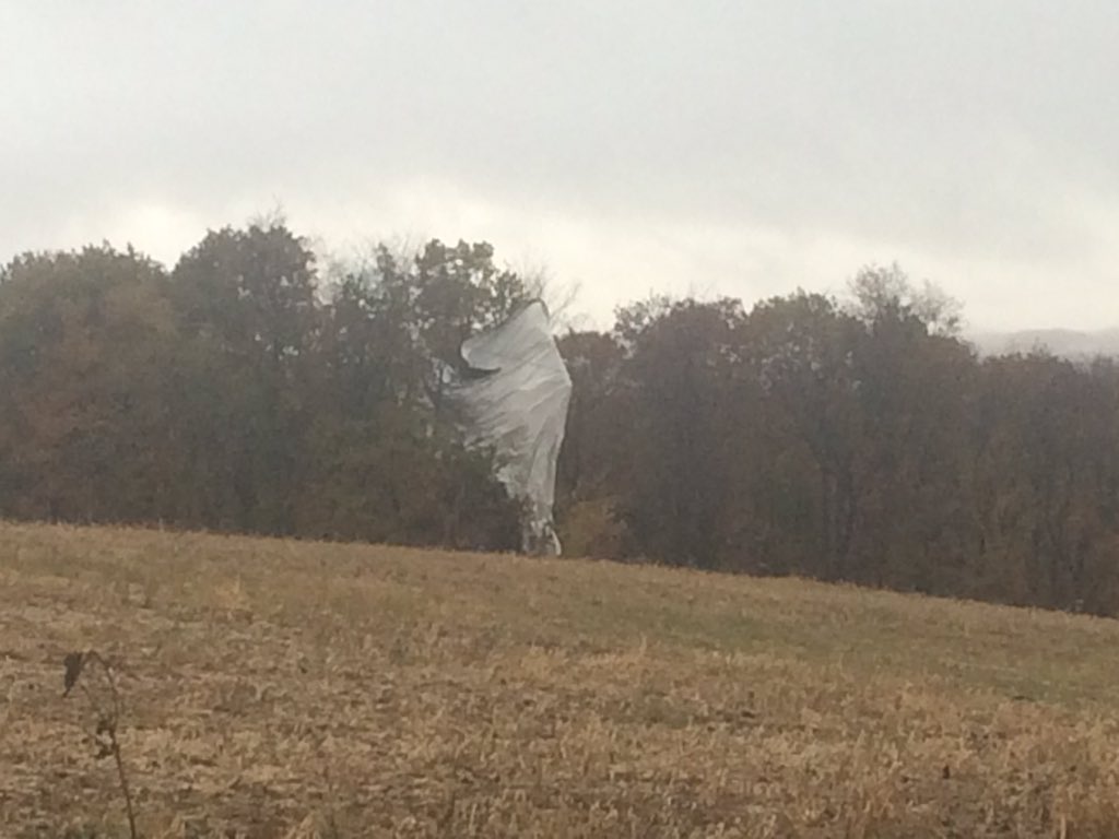
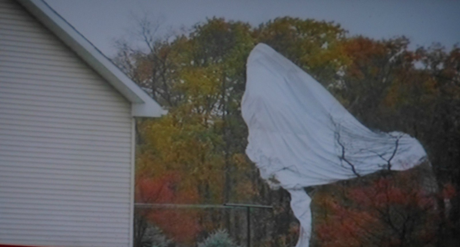
Here is the #blimp well part of it...in a tree near Muncy @WNEP: image via Nikki Krize Verified account @NikkiKrize, 28 October 2015 Pennsylvania, USA

Hay day. Making hay while the sun shines. (Cooper, Pennsylvania.): photo by fishhawk, 29 August 2015

Covered Bridge Road (I): Farm along Covered Bridge Road, Moreland Township, Lycoming County: photo by Nicholas A. Tonelli, 14 September 2014

Frazier Covered Bridge (I). Moreland Townaship, Lycoming County. The bridge was built in 1888 and is listed in the National Register of Historic Places. It crosses Little Muncy Creek in a quiet, secluded farming valley: photo by Nicholas A. Tonelli, 14 September 2014

Covered Bridge Road (I): Farm along Covered Bridge Road, Moreland Township, Lycoming County: photo by Nicholas A. Tonelli, 14 September 2014

Farming near Klingerstown, Pennsylvania: photo by Scott Bauer, 2005 (U.S. Dept. of Agriculture)
Evening. Sky patterns. (Danville, Pennsylvania.): photo by fishhawk, 29 August 2015
Silent Spring
Though the clouds suggest spraying the trees indicate autumn
Though the clouds suggest spraying the trees indicate autumn
THE RUNAWAY BLIMP DOWN NEAR MUNCY PA........These are not my pictures.......I went out to the scene from the restaurant in Turbotville only to be stopped by the Pa State Police about a mile from the blimp.......: image by Carl McDaniel, 29 October 2014

THE RUNAWAY BLIMP: image by Carl McDaniel, 29 October 2015

Lunar eclipse. Peak. (Danville, Pennsylvania.): photo by fishhawk, 27 September 2015

JLENS. We won't spy on you. Trust us.: image by Richard Thompson, 29 October 2015

JLENS_028: photo by Aberdeen Proving Grounds, 18 August 2014
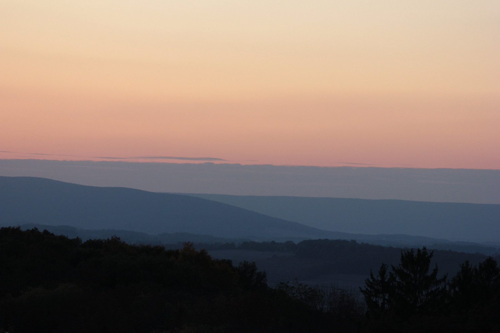
Ridgelines and valleys at sunset. Evening ridgeline landscape. (Danville, Pennsylvania.): photo by fishhawk, 12 October 2015