
Ae weet forenicht i’ the yow-trummle
I saw yon antrin thing,
A watergaw wi’ its chitterin’ licht
Ayont the on-ding;
An’ I thocht o’ the last wild look ye gied
Afore ye deed!
There was nae reek i’ the laverock’s hoose
That nicht -- an’ nane i’ mine;
But I hae thocht o’ that foolish licht
Ever sin’ syne;
An’ I think that mebbe at last I ken
What your look meant then.
Hugh MacDiarmid: The Watergaw, from Sangschaw, 1925
One wet, early evening in the sheep-shearing season
I saw that occasional, rare thing --
Broken shaft of a rainbow with its trembling light
Beyond the downpour of the rain
And I thought of the last, wild look you gave
Before you died.
The skylark’s nest was dark and desolate,
My heart was too
But I have thought of that foolish light
Ever since then
And I think that perhaps at last I know
What your look meant then.
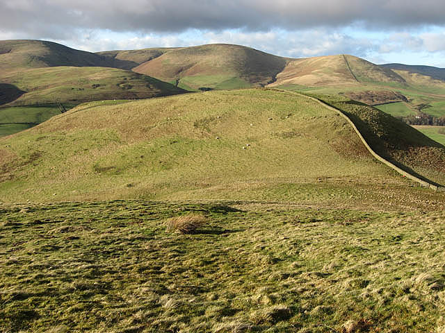
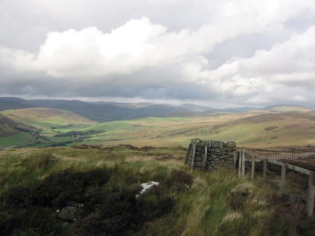
The col between Hog Hill and Loch Hill. Border hill countryside viewed in early February. The hill fort on Loch Hill is clearly visible beyond the col, and the drystone wall on the right runs through the middle of the fort: photo by Walter Baxter, 6 February 2008

Strait Knowes on Arkleton Hill. Arkleton Lochan is to the left by the trees: photo by Walter Baxter, 3 February 2007
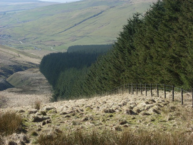
Forest edge, Clagberry Hill. Accompanying Fingland Burn on its way down to Logan Water: photo by Andrew Smith, 24 March 2007
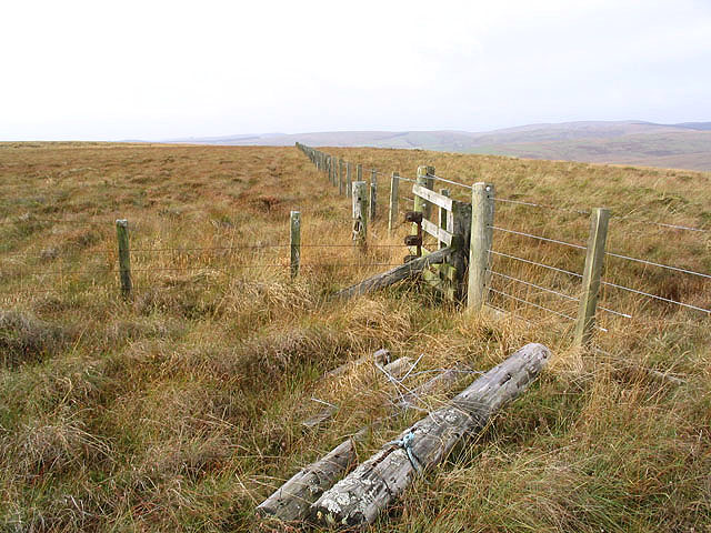
Fences on Bloch Hill: photo by Walter Baxter, 3 November 2007

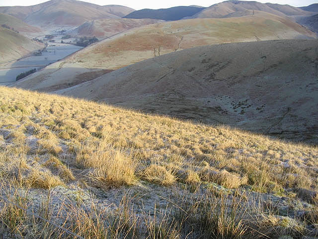
Sheep by the Hoghill Burn. Upland grazing countryside between Hog Fell and Hog Hill: photo by Walter Baxter, 6 February 2008
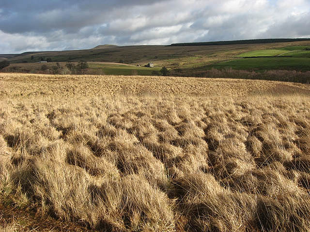
Rough grazing at Rashiel Sike. The top of Tinnis Hill is on the skyline centre left: photo by Walter Baxter, 6 February 2008

Rough grazing on Henbrae Hill. Hill grazing for cattle and sheep with Craig Hill centre right beyond the plantation. Viewed from the northern end of Black Knowe: photo by Walter Baxter, 22 September 2007

Logan Water and Arresgill. Looking down from Tansy Hill: photo by Andrew Smith, 22 March 2007

Rough grazing on Pike Fell. Looking down towards Mosspeeble: photo by Walter Baxter, 3 February 2007
Looking over Martin Hope from White Hill. The hills beyond include Seppings Hill and Blackhall Hill: photo by Walter Baxter, 3 February 2007
Monument Hill, Langholm: photo by David Ambridge, 4 October 2001

Clark Fell. Clark Fell (250m) is the hill in the foreground viewed from Mid Hill, with hills beyond in Ewesdale: photo by Walter Baxter, 22 September 2007

Arkleton Burn. Viewed in December from the edge of the square: photo by Walter Baxter, 16 December 2007
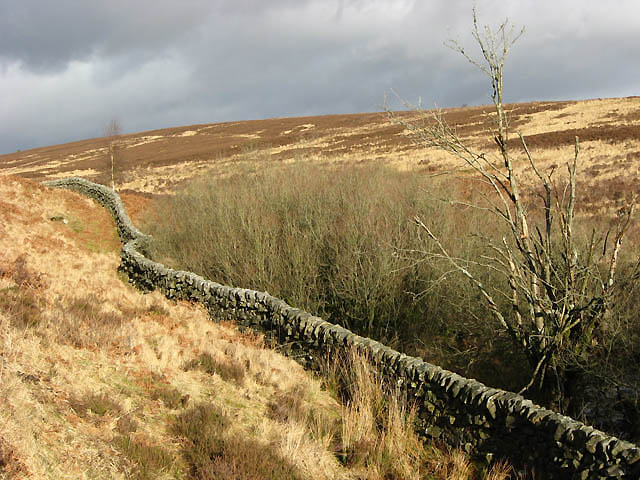
A drystane dyke near Little Tarras Water. In a moorland setting to the west of Little Tarras Water and viewed in early February: photo by Walter Baxter, 6 February 2008

A muddy track on Middleholm Hill: photo by Walter Baxter, 3 November 2007

A farm track on Auldshiels Hill, viewed on a cold December day: photo by Walter Baxter, 16 December 2007


11 comments:
The landscapes pictured are in the locale of Langholm, where the poet was born and where he dwelt until moving with his second wife to the Shetlands in 1933.
A helpful audio link to accompany this poem:
Hugh MacDiarmid reads and talks about The Watergaw
These pictures make me long for the time I was a student in Scotland. The Pentland Hills were not very far from the Heriot-Watt University campus and one Martian student – another stranger in a strange land – just loved to go there all by himself and roam the hills for hours on end. What can be seen on your photos look so much like the Pentlands that I first thought they had been taken there. Thanks for bringing some fond memories back.
Siganus Sutor
Sig,
Naturally it was among thoughts of you and Mars that I wandered in puttering, er putting together this little outing on the ether, er heather. Thanks for coming along.
It was my pleasure.
Who took these pictures? Friends? Have you been there?
(Incidentally, I remember some sort of "Robert Burns diner" at the university. Funny people sometimes, ces Écossais... I can't imagine another place where everyone in a university, no matter what they are studying, gathers in formal dressing in honour of a... poet.)
Siganus Sutor
PS – A bit frustrating, the way this blog compels commenters to sign. But that's just a one-sided opinion.
Sig,
Sorry about the sign-up claptrap, like many bloggers I have been forced latterly into the no-anonymous-comment mode because of a sea of noisome spam. Like yours my own personal memories of Scotland are confined to reveries from student days, in my case when I was a university student in England and an intrepid traveler. But that was half a century ago, currently my travel is entirely vicarious and fantastic, the actual voyaging limited to the immediate vicinity of my hutch. For this reason I'm enthralled by the virtual reality touring I am able to experience, for example, by visiting Crown in Norway, or you in Mauritius (or on Mars). When I post texts not writ by me I commonly seek out public domain art work or photos as accompaniment, as was the case with the wonderful photos here -- which brilliantly illuminate the starkly beautiful patch of Earth from which the late Scottish poet MacDiarmid hailed.
Tom,
NIce to find this here, Johnny and I back from another trip up to the mountains (all recovered in new white snow), Hog Hill and Loch Hill and Arkleton Hill and Clagberry Hill and Bloch Hill and Hoghill Burn and all looking a bit like these now green West Marin hills, as ye know. . .
3.4
light coming into sky above black plane
of ridge, jet passing above pine branch
in foreground, sound of wave in channel
that is therefore to appear,
by which being itself
a picture simplifies things
a little, that is, in
whiteness of peak in cloudless blue sky,
sunlit trees on ridge to the left of it
Tom always manages to find the most extraordinary photographs to accompany his text, things that aren't on google images. I'd forgotten you were in Scotland, Sig. Ø at my blog is also very keen on Scotland. Some of the pictures of the blasted heath look quite like Norway.
"The raven himself is horse."
Macbeth 1,v,38.
Artur.
The Watergaw is splendid. So are these pictures. If the week wasn't aborning (licht is chitterin' now, just), I'd abandon what I loosely call my "plans" and watch The 39 Steps this morning. Curtis
Artur,
My kingdom for a blasted heath!
The Twa Rivers, wherein England and Scotland join together to advance toward Norway, could it seems never get along, though one flowed into the other. Isn't it always the way?
And yes, Steve, as the old castle rocked and rattled in a temblor on the Hayward Fault moments ago, there came from ayont yon boiling cauldron of toil and trouble the voice of an Ancient -- "It's time to head for the hills".
On the train. With Curtis.
The cats are still in terror. And two of them were sick already.
What, because of the quake? Poor cats!
No, two of them have been quite ill for the past ten days or so. They are none of them getting any younger, and two no longer venture outdoors, where the wild pleasures and dangers and rough weather and other creatures are. (One empathizes.) But the one persistent outdoor adventurer appears to have "picked something up", got quite sick himself and infected one of the others with it. Both are now worrisomely afflicted, and it was in this semi-comatose state they were when the earthquake hit. It was right under us, five miles down. (We sit atop -- if not always suffer from -- a massive fault.) In amidst the chaos of falling objects, the two sick cats bolted as if shot from guns. Now however an anxious calm has returned, and with it, the worrisome semi-comatose state.
These creatures are our companions in sickness and health.
I suppose when in better health they would say the same of us, could they speak.
Post a Comment