
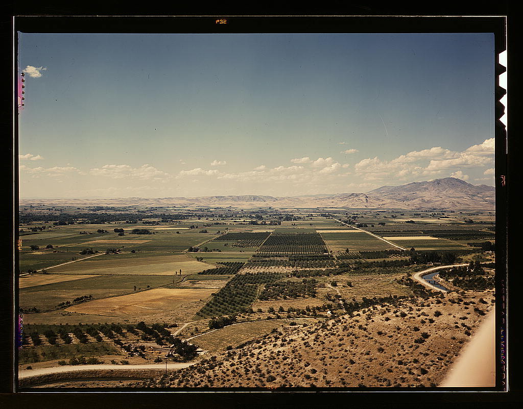
Cherry orchards and farm lands at Emmett, Gem County. Notice the wide irrigation ditches. Water for irrigation is supplied by the Black Canyon Reservoir: photo by Russell Lee, July 1941
Where the water went
the people weren't
far behind, in that
wide wilderness
often rainless
seldom painless
and the man
with the camera
following the signs
left by the managers
of the land, just ahead
of the arrival
of agribusiness -- the flow
of waters diverted
and taken
from the public hand
in the fullness
of time
it was always going
to be somebody else's
signed
sealed
and delivered
private
Idaho
Cherry orchards and irrigation ditch at Emmett, Idaho: photo by Russell Lee, July 1941
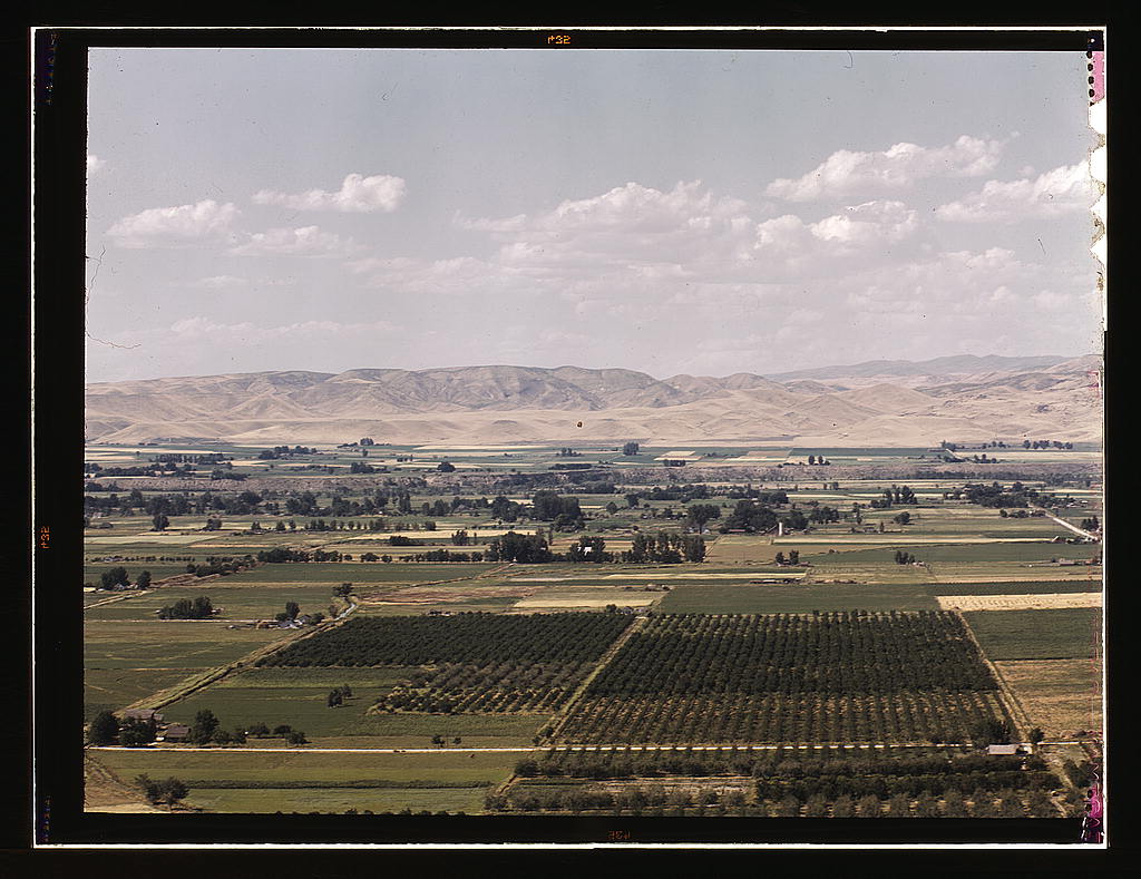
Cherry orchards, farm lands and irrigation ditch at Emmett, Idaho: photo by Russell Lee, July 1941
Cherry orchards near Emmett, Gem County, Idaho. About 200 carloads of black bing cherries are shipped from Idaho yearly: photo by Russell Lee, July 1941
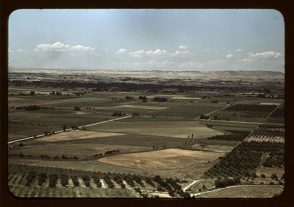
Cherry orchards and farming land at Emmett, Idaho: photo by Russell Lee, July 1941
Cherry orchards, farm land and irrigation ditch at Emmett, Idaho: photo by Russell Lee, July 1941

Sign of Black Canyon irrigation project, Canyon County, Idaho: photo by Russell Lee, June 1941

Mailbox. Canyon County, Idaho. While this country is dry and sagebrush covered, the farmers expect it to be in crops in three or four years when irrigation water is supplied by the Black Canyon irrigation project: photo by Russell Lee, May 1941

Irrigation ditch near Caldwell, Canyon County, Idaho: photo by Russell Lee, June 1941

Irrigation ditch near Caldwell, Canyon County, Idaho: photo by Russell Lee, June 1941

Irrigated farming land with mountains surrounding. Canyon County, Idaho. More than half of cultivated land in Idaho is under irrigation and this irrigated land is definitely on the increase: photo by Russell Lee, June 1941

Lateral irrigation ditch in orchard, Canyon County, Idaho: photo by Russell Lee, June 1941

Corn field. Canyon County, Idaho. Idaho is first in acre yield of corn in states west of the Mississippi. Practically all corn grown is used: photo by Russell Lee, May 1941

Outlet gates at Deer Flat Reservoir. Water is used for irrigation in Canyon County, Idaho: photo by Russell Lee, June 1941

Near Caldwell, Idaho: photo by Russell Lee, June 1941

Water fountain, Caldwell, Idaho: photo by Russell Lee, June-July 1941

Water fountain, Caldwell, Idaho: photo by Russell Lee, June-July 1941

Swimming pool, Caldwell, Idaho: photo by Russell Lee, July 1941

Sun bathers at the park swimming pool, Caldwell, Idaho: photo by Russell Lee, July 1941

Filling the street-sprinkling wagon, Caldwell, Idaho: photo by Russell Lee, July 1941

Sprinkling the dusty streets, Caldwell, Idaho: photo by Russell Lee, July 1941

Milk and butter fat receiving depot and creamery, Caldwell, Idaho: photo by Russell Lee, July 1941

Grain elevator, Caldwell, Idaho: photo by Russell Lee, July 1941

Grain elevator, Caldwell, Idaho: photo by Russell Lee, July 1941

Grain elevators and flour mill, Caldwell, Idaho: photo by Russell Lee, July 1941

Grain elevators, Caldwell, Idaho: photo by Russell Lee, July 1941
Photos by Russell Lee from Farm Security Administration/Office of War Information Collection, Library of Congress


6 comments:
Tom,
Love that milk can mailbox and the tyke on his tiptoes at the fount; the photos and the poem take me back to my brief I-90 passing through Idaho in 1976 on my way east—by the way, where were you in 1941? :)
Vassilis,
Thanks for bringing your sagesse to water this patch of dry sage.
A bit of geography and history perhaps helps with this one.
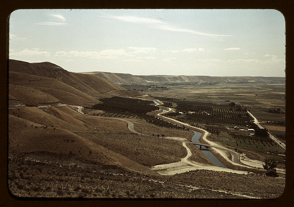
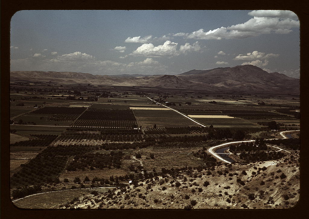
The main stem of the Payette River in southwestern Idaho flows west into Black Canyon Reservoir. Below the reservoir's dam, the river flows past Emmett before emptying into the Snake at the Oregon border.
Water is diverted at the Black Canyon Diversion Dam by gravity into the Black Canyon Main Canal on the south side of the Payette and by two direct connected turbine-driven pumps, located in the powerhouse, to serve the Emmett Irrigation District Canal on the north side of the river.
The results can be seen from high above in this view of the lower course of the Payette River, below Black Canyon Diversion Dam.
Historical water management in this region is responsible for the red patch in the lower left on this Idaho population map.
Lee's shot of that mailbox in the arid landscape here (chosen to show the "before" to this "after") is graphic evidence that before water management, this place was a desert.
The logos of Swift, Union Pacific & c. show that water management paved the way for big time agribusiness.
Over in the southeast corner of the state, near the Wyoming border, as the pop-map shows, there was, on the other hand, little water to be managed. The 1930s droughts brought farm failures and poverty; the FSA entered the picture to assist farmers in turning to grazing instead:
Arthur Rothstein: Dry Land Grazing (Idaho, 1936)
And by the by, as you have asked -- at the time Russ Lee took these pictures in the early summer of 1941, I was less large even than that ambitious water-fountain tyke, and living out on the West... side of Chicago.
Ed Dorn, a fellow native of Illinois (the farm country downstate), who showed up in England in 1965 direct from Idaho, called me, at that time, a "Chicago buster" -- the "country" way of suggesting that the big city, for all its alleged big shoulder-ism, in fact had no sod left to bust.
For all that this is long and flows and develops, the poem and pictures really "snap" together. You can feel and almost hear that snap and this makes "Russell Lee: Uses of Water (Idaho, 1941)" powerful art. Curtis
Thanks very much, Curtis. There come times one can't keep from pondering upon the water, where does it come from, and where does it go...
I love that poem, whose own flow subtly suggests its subject.
Thanks for getting that, Terry. It was indeed meant to trickle down.
As for that matter wasn't money once in mythic times thought to do?
But as with money too, the diversions and catchments and bottlenecks along the way...
Post a Comment