
Residents of Mulky Square, a low-income neighborhood on the city's west side, face large scale displacement by a new interstate highway (I-635). Many houses have been demolished, others stand empty. For the people who remain, life goes on with very little change. On Saturday in a neighborhood tavern, Ernest Watkins of Mulky Square finds his favorite relaxation. Mr. Watkins, father of nine, is a biscuit company worker: photo by Kenneth Paik (1940-2006) for the Environmental Protection Agency, September 1973 (US National Archives)
I...Ernest Watkins

Mulky Square neighbors meet over a beer. This low-income neighborhood faces major disruption with the projected building of a new highway (I-635) through the area: photo by Kenneth Paik (1940-2006) for the Environmental Protection Agency, October 1973 (US National Archives)

Ernest Watkins in his Mulky Square home. Mr. Watkins, father of nine, is a biscuit company worker: photo by Kenneth Paik (1940-2006) for the Environmental Protection Agency, October 1973 (US National Archives)

Ernest Watkins of Mulky Square, biscuit company worker and father of nine, sits on his front doorstep with his three-year-old son: photo by Kenneth Paik (1940-2006) for the Environmental Protection Agency, October 1973 (US National Archives)

Ernest Watkins of Mulky Square, biscuit company worker and father of nine, likes his beer and likes teaching his three-year-old son to like it: photo by Kenneth Paik (1940-2006) for the Environmental Protection Agency, October 1973 (US National Archives)

Ernest Watkins in his Mulky Square home. Mr. Watkins, father of nine, is a biscuit company worker: photo by Kenneth Paik (1940-2006) for the Environmental Protection Agency, October 1973 (US National Archives)
Weekends for this Mulky Square biscuit company worker and father of nine mean beer and sleep. Mulky Square, an area of low income families on the city's west side, is soon to be torn up for a new interstate highway: photo by Kenneth Paik (1940-2006) for the Environmental Protection Agency, October 1973 (US National Archives)
II...May Watkins and Watkins children

Mrs. May Watkins of Mulky Square with her three-year-old son Kevin, one of nine Watkins children: photo by Kenneth Paik (1940-1966) for the Environmental Protection Agency, October 1973 (US National Archives)

Mrs. May Watkins cuddles the youngest of her nine children on the front porch of their of Mulky Square home. This west side neighborhood of low-income families will soon be torn up to make way for a new interstate highway: photo by Kenneth Paik (1940-1966) for the Environmental Protection Agency, October 1973 (US National Archives)

The Watkins of Mulky Square, a family of eleven, live in the 1600 block of Madison Street, a few blocks from the area being cleared for I-95. On the Watkins front porch: Mrs Watkins, her son, daughter-in-law and grandchild: photo by Kenneth Paik (1940-1966) for the Environmental Protection Agency, October 1973 (US National Archives)

A barefoot Mrs. May Watkins (right) sits in her Mulkey Square house with the youngest of her nine children and a daughter-in-law. Much of her time is spent like this. The kitchen in the background badly needs cleaning, but the incentives are lacking: photo by Kenneth Paik (1940-2006) for the Environmental Protection Agency, October 1973 (US National Archives)

Young Kevin Watkins goes to sleep while his nephew (his second brother's son) eats a bowl of cereal on the living room floor. Kevin is one of nine children in a Mulky Square biscuit worker's family: photo by Kenneth Paik (1940-2006) for the Environmental Protection Agency, October 1973 (US National Archives)

Residents of Mulky Square, a low-income neighborhood on the city's west side, face large scale displacement by a new interstate highway (I-635). Many houses have been demolished, others stand empty. For the people who remain, life goes on with very little change. Mrs May Watkins, mother of nine, on the porch of her Mulky Square house: photo by Kenneth Paik (1940-2006) for the Environmental Protection Agency, October 1973 (US National Archives)
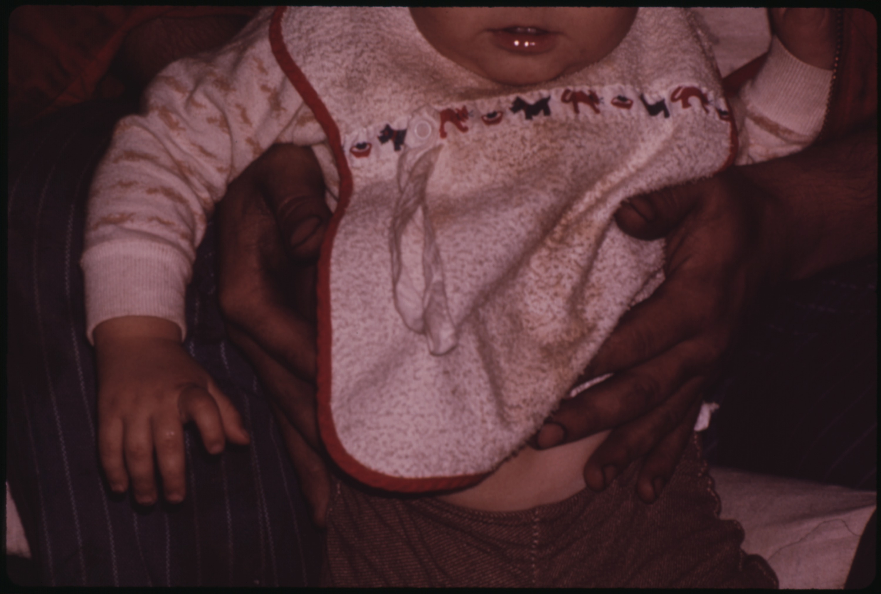
Dirty hands of one of the nine children of Mulky Square biscuit worker hold small nephew. In this family love of children is strong but sanitation belongs to a different world. Mulky Square is a low-income area soon to be torn up by a new interstate highway: photo by Kenneth Paik (1940-2006) for the Environmental Protection Agency, October 1973 (US National Archives)

A barefoot Mrs. May Watkins, mother of nine, shares couch in her Mulkey Square living room, Kansas City, with two of her daughters. They find shoes more to their liking: photo by Kenneth Paik (1940-2006) for the Environmental Protection Agency, October 1973 (US National Archives)

Mrs. May Watkins and one of her nine children in the living room of their Mulky Square home, Kansas City. Mrs. Watkins' husband works for a local biscuit company: photo by Kenneth Paik (1940-2006) for the Environmental Protection Agency, October 1973 (US National Archives)

Diane Watkins, one of nine children of a Mulky Square family, eats on the living room couch. The only table in the house is occupied by her 14-year-old sister: photo by Kenneth Paik (1940-2006) for the Environmental Protection Agency, October 1973 (US National Archives)

Diane Watkins, 9, in bedroom of her family's house in Mulky Square. Diane is one of the nine children of a biscuit company worker and his wife. Area soon to be torn up to make way for a new interstate highway (I-635): photo by Kenneth Paik (1940-2006) for the Environmental Protection Agency, October 1973 (US National Archives)

Going to exchange empties for more soda pop in Mulky Square, a low-income neighborhood on the city's west side. Residents face uprooting by a new interstate highway (I-95): photo by Kenneth Paik (1940-2006) for the Environmental Protection Agency, October 1973 (US National Archives)
III...Watkins boys

The Watkins of Mulky Square, a family of eleven, live in the 1600 block of Madison Street, a few blocks from the area being cleared for I-635. The older Watkins boys tinker with cars, a favorite occupation: photo by Kenneth Paik (1940-2006) for the Environmental Protection Agency, October 1973 (US National Archives)

Residents of Mulky Square, a low-income neighborhood on the city's west side, face large scale displacement by a new interstate highway (I-635). Many houses have been demolished, others stand empty. For the people who remain, life goes on with very little change. Mrs May Watkins with the wife of one of her sons on the Watkins' front porch: photo by Kenneth Paik (1940-2006) for the Environmental Protection Agency, October 1973 (US National Archives)

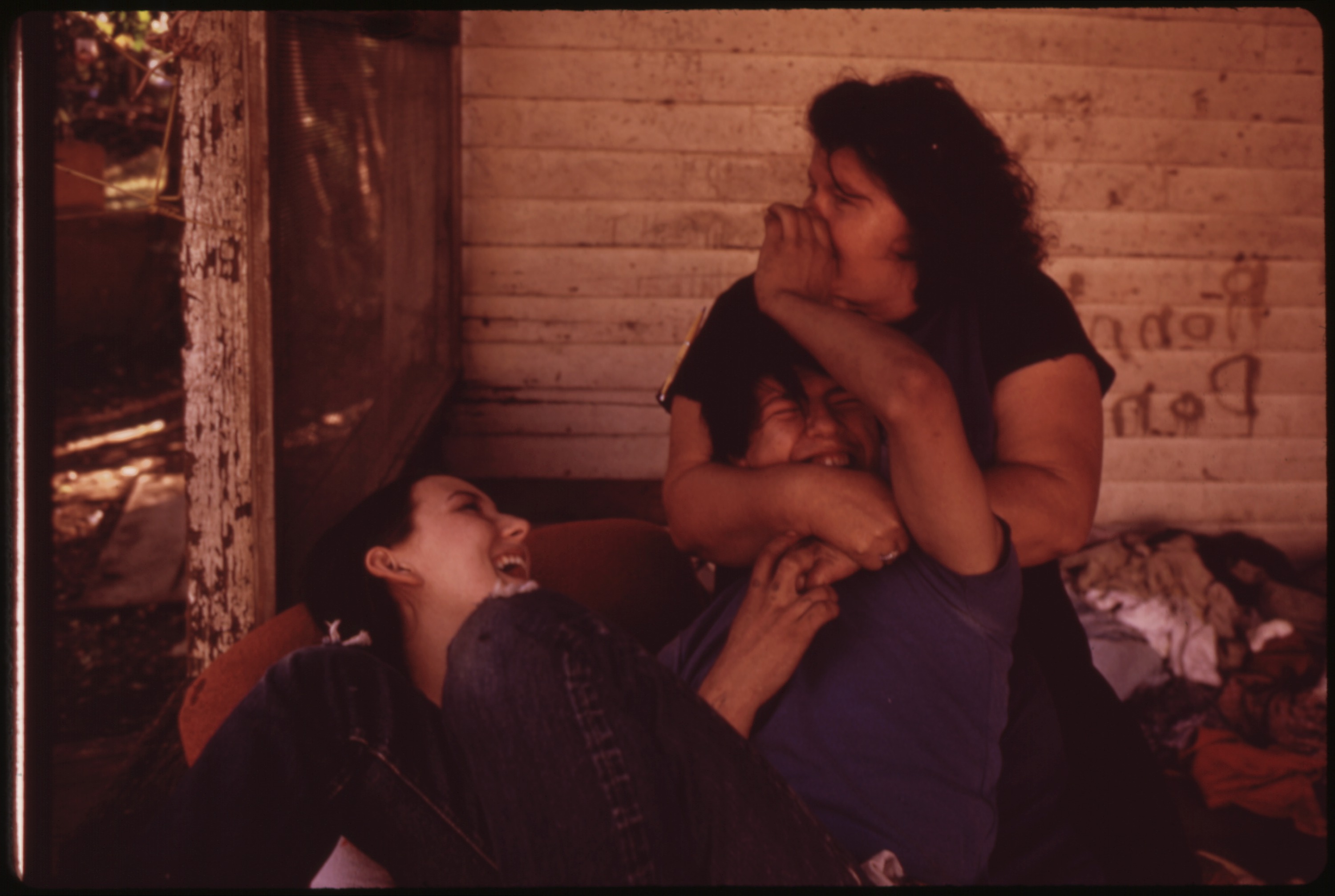
Wife of Dale Watkins, one of nine children of a Mulky Square family, performs a little cosmetic surgery on her husband's face. Mulky Square is a deteriorating neighborhood of low-income famlies, soon to be torn up to make way for a new interstate highway: photo by Kenneth Paik (1940-1966) for the Environmental Protection Agency, October 1973 (US National Archives)
Wife of Dale Watkins, one of nine children of a Mulky Square family, performs a little cosmetic surgery on her husbands's face. Mulky Square is a deteriorating neighborhood of low-income famlies, soon to be torn up to make way for a new interstate highway: photo by Kenneth Paik (1940-1966) for the Environmental Protection Agency, October 1973 (US National Archives)

Doodles of Dale Watkins, one of nine children in a Mulky Square biscuit worker's family. An isolated, poor and deteriorating neighborhood, Mulky Square faces major disruption from a new interstate highway: photo by Kenneth Paik (1940-2006): photo by Kenneth Paik (1940-2006) for the Environmental Protection Agency, October 1973 (US National Archives)

Billy and Sandy Watkins call to a friend on the street from the doorway of their Mulkey Square home, Kansas City: photo by Kenneth Paik (1940-2006) for the Environmental Protection Agency, October 1973 (US National Archives)
Billy Watkins, one of nine children in a biscuit worker's family, broods on the stairs of their Mulky Square house: photo by Kenneth Paik (1940-2006) for the Environmental Protection Agency, October 1973 (US National Archives)

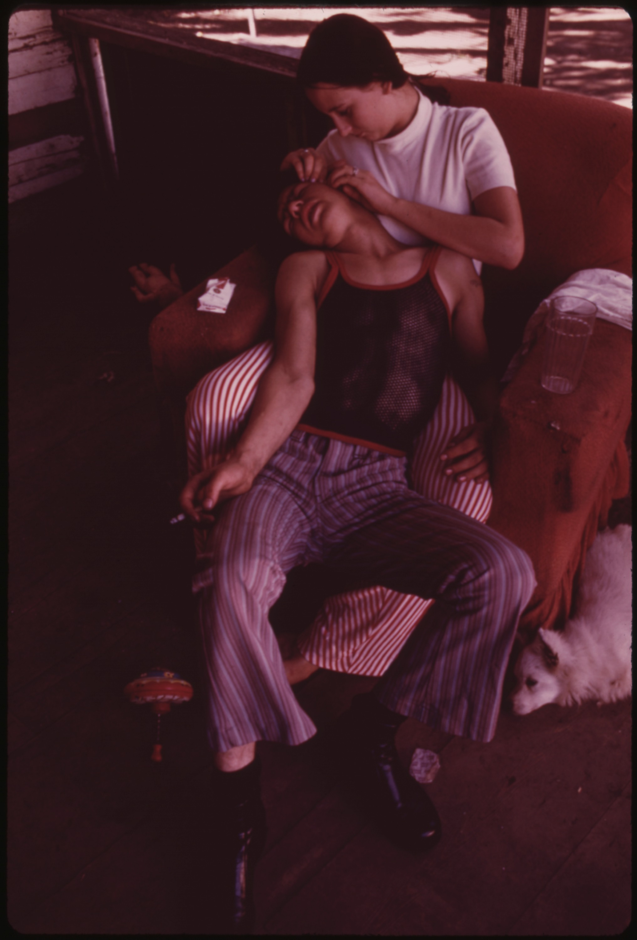
Billy Watkins, one of nine children in a Mulky Square family, doesn't go to school, but amuses himself sometimes by writing and drawing: photo by Kenneth Paik (1940-2006) for the Environmental Protection Agency, October 1973 (US National Archives)

Billy Watkins, one of nine children of a biscuit worker's family, gets himself a bowl of cereal in the kitchen of their Mulky Square home: photo by Kenneth Paik (1940-2006) for the Environmental Protection Agency, October 1973 (US National Archives)

Billy Watkins eats a bowl of cereal in the living room of his house in Mulky Square, Kansas City, Billy is one of nine children of a biscuit company worker and his wife: photo by Kenneth Paik (1940-2006) for the Environmental Protection Agency, October 1973 (US National Archives)

Look, Ma, one wheel. Billy Watkins of Mulkey Square, Kansas City, can ride like this for a whole block, and has even offered to teach others the trick for a small fee -- but so far has found no takers: photo by Kenneth Paik (1940-2006) for the Environmental Protection Agency, September 1973 (US National Archives)

Residents of Mulky Square, a low-income neighborhood on the city's west side, face large scale displacement by a new interstate highway (I-635). Many houses have been demolished, others stand empty. For the people who remain, life goes on with very little change. Billy Watkins plays with an old tire in a cleared-out section now used as a dump. Billy, one of nine children in a biscuit worker's family, doesn't go to school and has a lot of time to kill: photo by Kenneth Paik (1940-2006) for the Environmental Protection Agency, October 1973 (US National Archives)

Residents of Mulky Square, a low-income neighborhood on the city's west side, face large scale displacement by a new interstate highway (I-635). Many houses have been demolished, others stand empty. For the people who remain, life goes on with very little change. Billy Watkins, one of nine children in a biscuit worker's family, passes a run-down apartment building on his way home. The tenants have gone, the building is closed: photo by Kenneth Paik (1940-2006) for the Environmental Protection Agency, October 1973 (US National Archives)

Residents of Mulky Square, a low-income neighborhood on the city's west side, face large scale displacement by a new interstate highway (I-635). Many houses have been demolished, others stand empty. For the people who remain, life goes on with very little change. Billy Watkins, one of nine children in a biscuit worker's family, passes through a now-deserted section of the neighborhood. Billy does not go to school and much of each day is spent "killing time": photo by Kenneth Paik (1940-2006) for the Environmental Protection Agency, October 1973 (US National Archives)
IV...Mulky Square kids

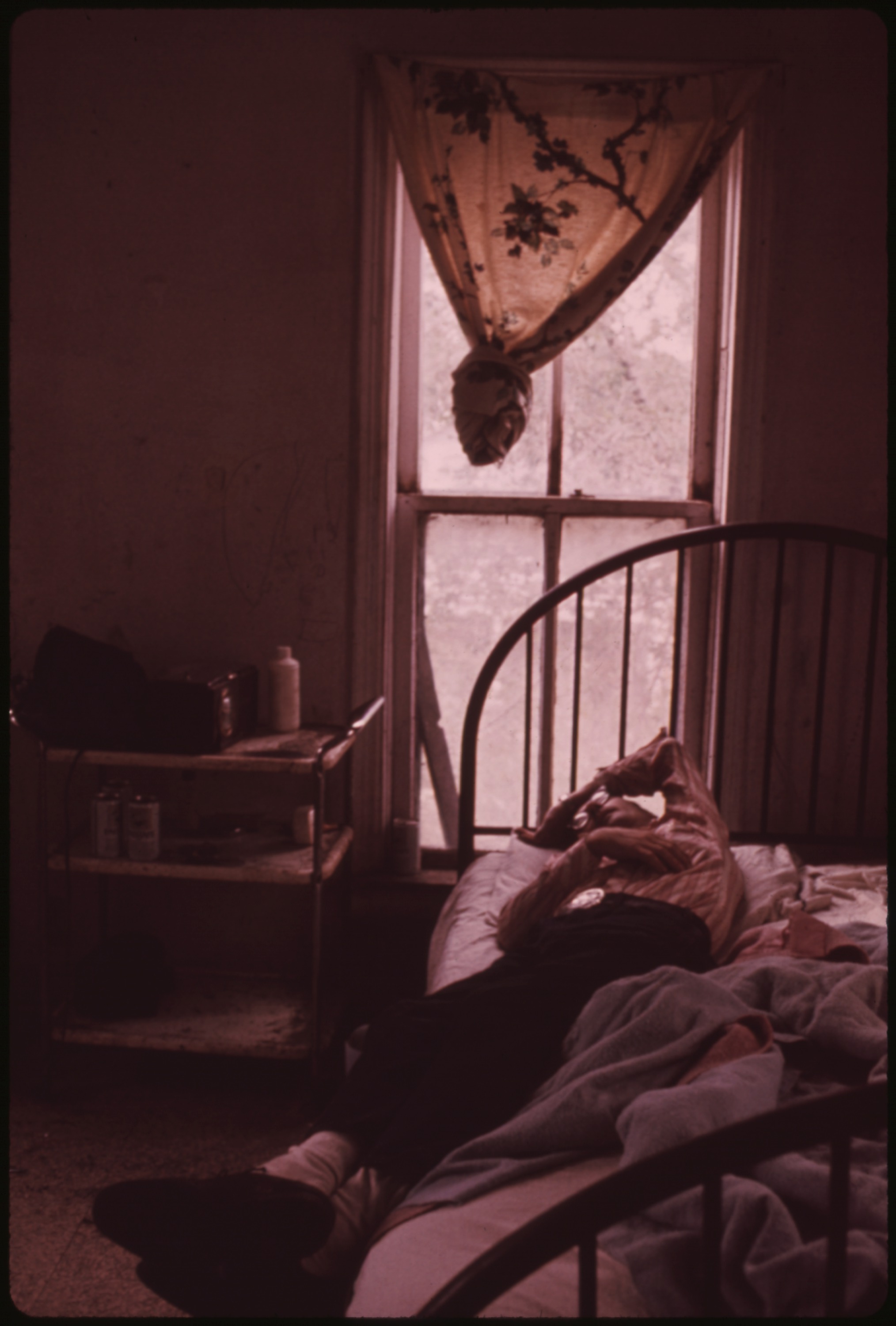
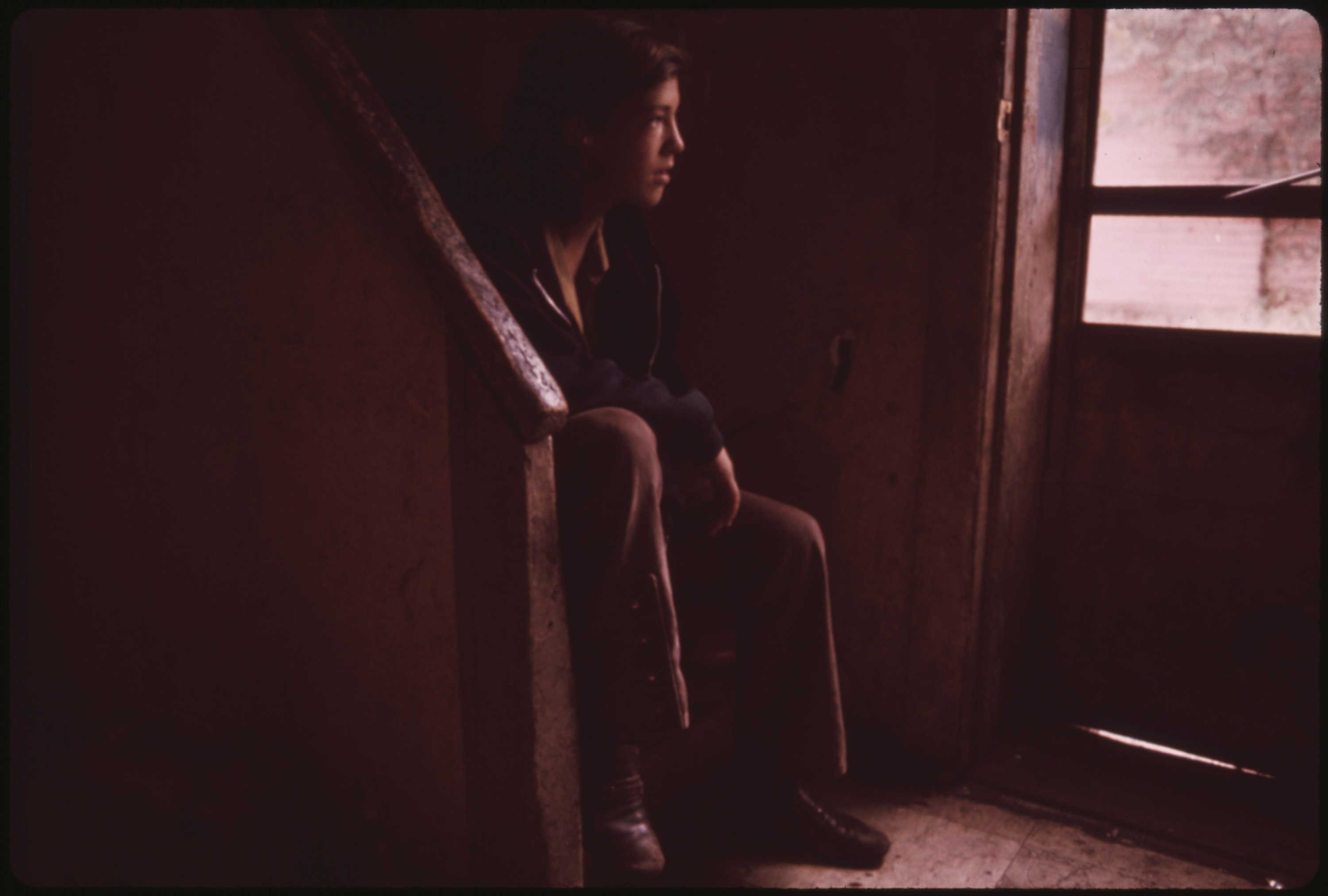
Mulky Square child looks out of a screen door on a rainy day. His family occupies part of a building that will soon be razed to make way for a new interstate highway (I-635). Many other houses on the street have already been abandoned: photo by Kenneth Paik (1940-1966) for the Environmental Protection Agency, September 1973 (US National Archives)

Mulky Square child looks out of a screen door on a rainy day. His family occupies part of a building that will soon be razed to make way for a new interstate highway (I-635). Many other houses on the street have already been abandoned: photo by Kenneth Paik (1940-1966) for the Environmental Protection Agency, September 1973 (US National Archives)
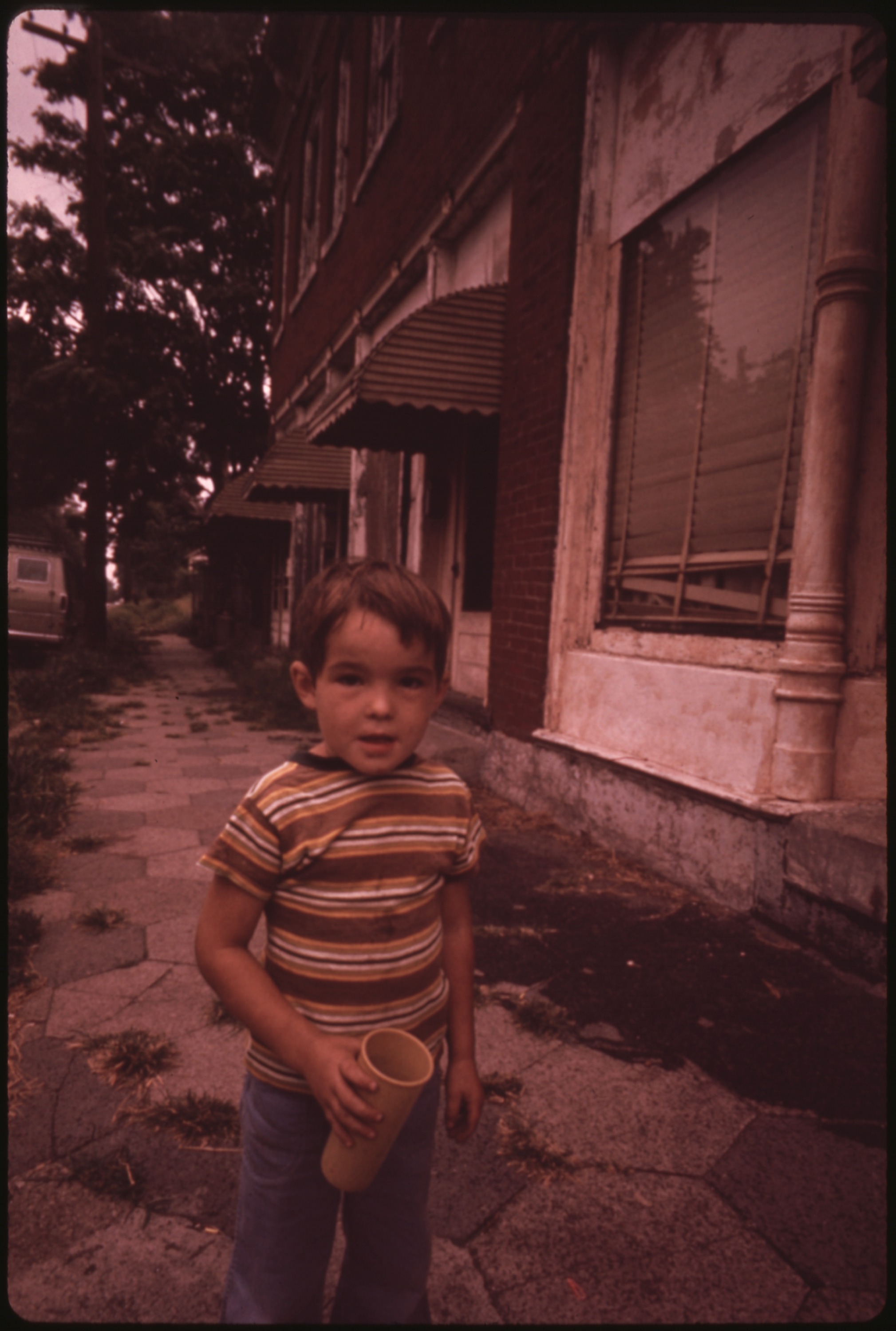
Mulky Square, an isolated, low-income area on the city's west side, is soon to be torn up to make way for a new interstate highway. Many houses stand vacant. A part of this building is still occupied by a family. Their children play around the building: photo by Kenneth Paik (1940-1966) for the Environmental Protection Agency, September 1973 (US National Archives)

Looking over the "West Bottoms" of Kansas City from Mulky Square Park, a city facility. Park monument makes good climbing: photo by Kenneth Paik (1940-2006) for the Environmental Protection Agency, September 1973 (US National Archives)

Playing football at Mulky Square Park, a city facility: photo by Kenneth Paik (1940-1966) for the Environmental Protection Agency, September 1973 (US National Archives)
Mulky Square area children playing in roadside trash. Within five blocks of the area are a park and recreation area provided by the city: photo by Kenneth Paik (1940-2006) for the Environmental Protection Agency, September 1973 (US National Archives)

Mulky Square youth with cowboy gear and transistor: photo by Kenneth Paik (1940-2006) for the Environmental Protection Agency, September 1973 (US National Archives)

Residents of Mulky Square, a low-income neighborhood on the city's west side, face large scale displacement by a new interstate highway (I-635). Many houses have been demolished, others stand empty. For the people who remain, life goes on with very little change. For neighborhood children, go-cart races are still big weekend fun: photo by Kenneth Paik (1940-2006) for the Environmental Protection Agency's Documerica project, October 1973 (US National Archives)

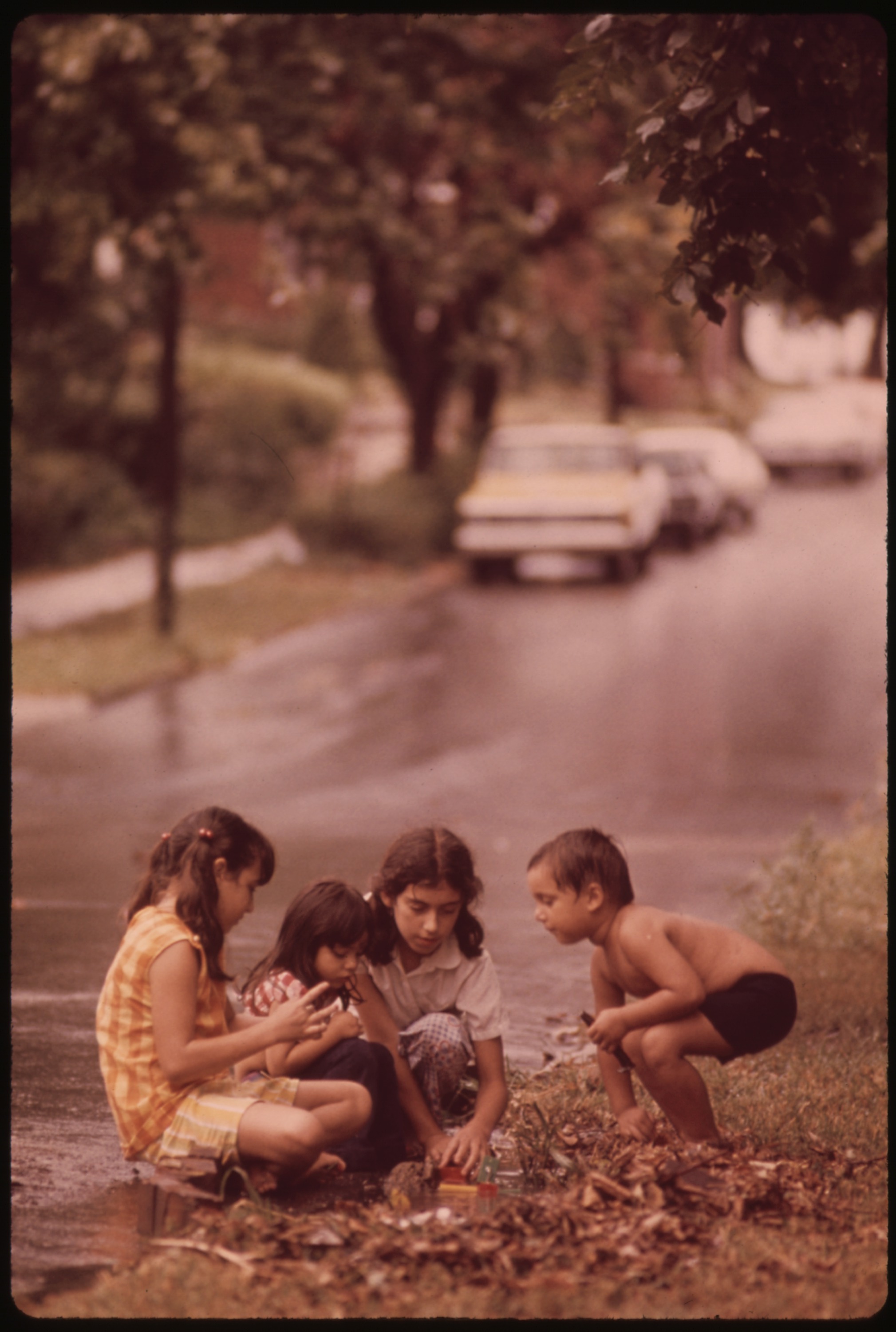
Children play in Mulky Square, a low income area soon to be torn up to make way for a new interstate highway: photo by Kenneth Paik (1940-2006) for the Environmental Protection Agency, October 1973 (US National Archives)

Donny, a neighborhood youngster, drags on a cigarette passed to him by an older boy: photo by Kenneth Paik (1940-2006) for the Environmental Protection Agency, September 1973 (US National Archives)

Mulky Square youngsters show off their tattoos -- everybody has them. "It don't hurt," they assure the photographer: photo by Kenneth Paik (1940-2006) for the Environmental Protection Agency, September 1973 (US National Archives)

Mulky Square girl offers her raccoon, but it still isn't good enough to win her a place in the gang: photo by Kenneth Paik (1940-2006) for the Environmental Protection Agency, September 1973 (US National Archives)

Harold, a Mulkey Square boy who says that he spent a year at the Missouri Boys' Reformatory in Boonville, shows off his smoking style and his tattoos. Younger boys accept Harold as a natural leader: photo by Kenneth Paik (1940-2006) for the Environmental Protection Agency, October 1973 (US National Archives)

Mulky Square is a neighborhood on the west side of Kansas City, an area of low-income dwellings. I-635 will cut right through Mulky Square, which is already isolated by railroad yards on the west, I-70 on the north and I-35 plus a 4-lane freeway on the east. Buildings are being closed down. These brothers talk about moving to California as they sit on the steps of an already abandoned house on the 1600 block of Madison Street outside the area being cleared for I-635: photo by Kenneth Paik (1940-2006): photo by Kenneth Paik (1940-2006) for the Environmental Protection Agency, October 1973 (US National Archives)
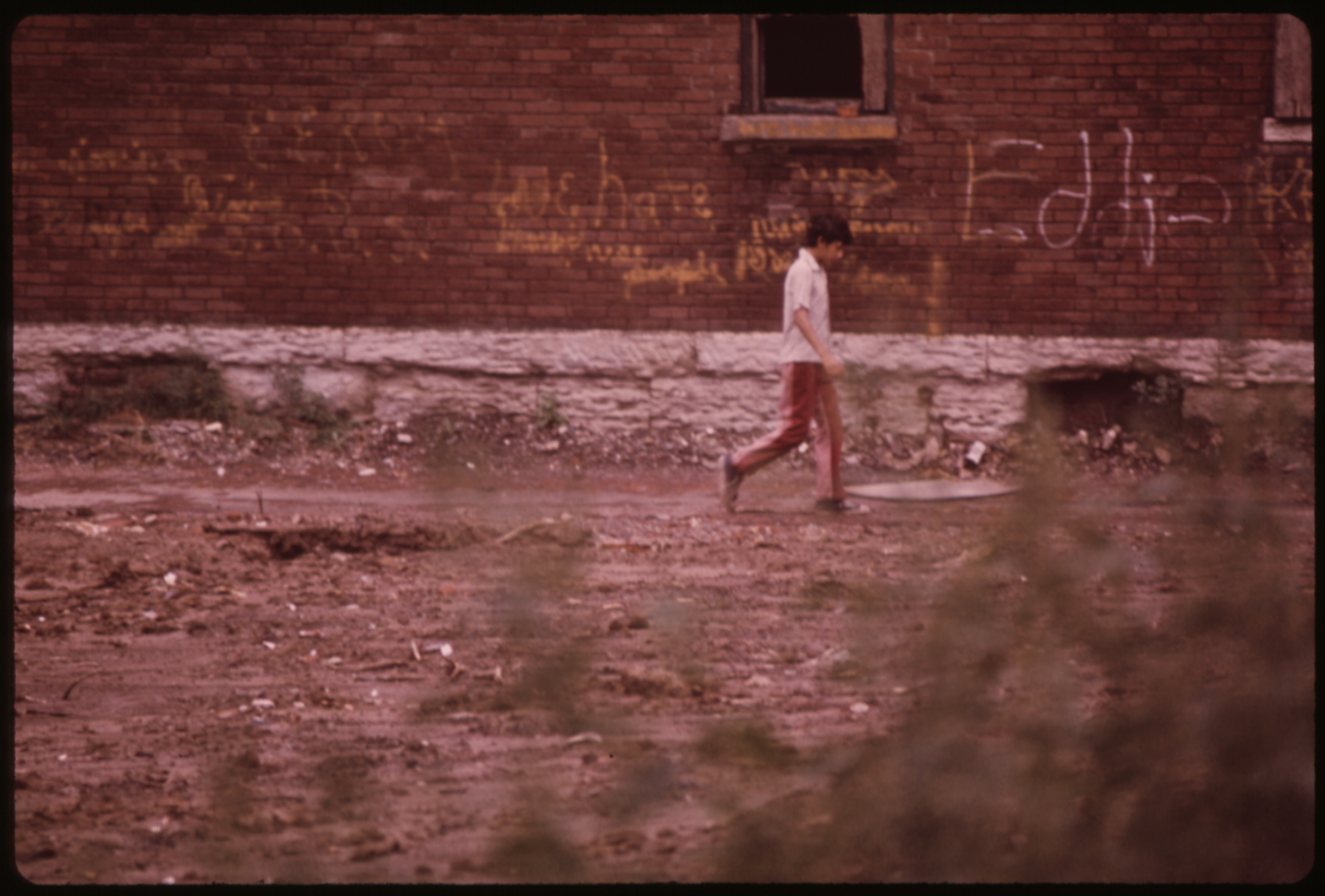
Mulky Square boy walks past a building marked for demolition to make way for a new interstate highway (I-635). The building of the road through the area means large-scale displacement for the residents: photo by Kenneth Paik (1940-2006) for the Environmental Protection Agency, October 1973 (US National Archives)
V...Vulnerability -- the elderly

Elderly resident of Mulky Square must soon find new lodging. Her present home is in the path of I-635: photo by Kenneth Paik (1940-2006): photo by Kenneth Paik (1940-2006) for the Environmental Protection Agency, October 1973 (US National Archives)

Mulky Square is a neighborhood in the west side of Kansas City, an area of low-income dwellings. I-635 will cut right through Mulky Square, which is already isolated by railroad yards on the west, I-70 on the north plus a 4-lane freeway on the east. This building in the West 700 block of 16th street is coming down. Finding other housing for the same rent is a problem: photo by Kenneth Paik (1940-1966) for the Environmental Protection Agency, October 1973 (US National Archives)

Mulky Square is a neighborhood in the west side of Kansas City, an area of low-income dwellings. I-635 will cut right through Mulky Square, which is already isolated by railroad yards on the west, I-70 on the north plus a 4-lane freeway on the east. This elderly woman, living on social security, must find other lodging because her present home is in the path of I-635: photo by Kenneth Paik (1940-1966) for the Environmental Protection Agency, October 1973 (US National Archives)

Elderly residents of this building in the West 700 block of 16th Street in Mulky Square must find other lodging soon. Their present home is in the path of I-635: photo by Kenneth Paik (1940-2006): photo by Kenneth Paik (1940-2006) for the Environmental Protection Agency, October 1973 (US National Archives)

Elderly residents of this building in the West 700 block of 16th Street in Mulky Square must find other lodging soon. Their present home is in the path of I-635: photo by Kenneth Paik (1940-2006): photo by Kenneth Paik (1940-2006) for the Environmental Protection Agency, October 1973 (US National Archives)

Elderly residents of this building in the West 700 block of 16th Street in Mulky Square must find other lodging soon. Their present home is in the path of I-635: photo by Kenneth Paik (1940-2006): photo by Kenneth Paik (1940-2006) for the Environmental Protection Agency, October 1973 (US National Archives)
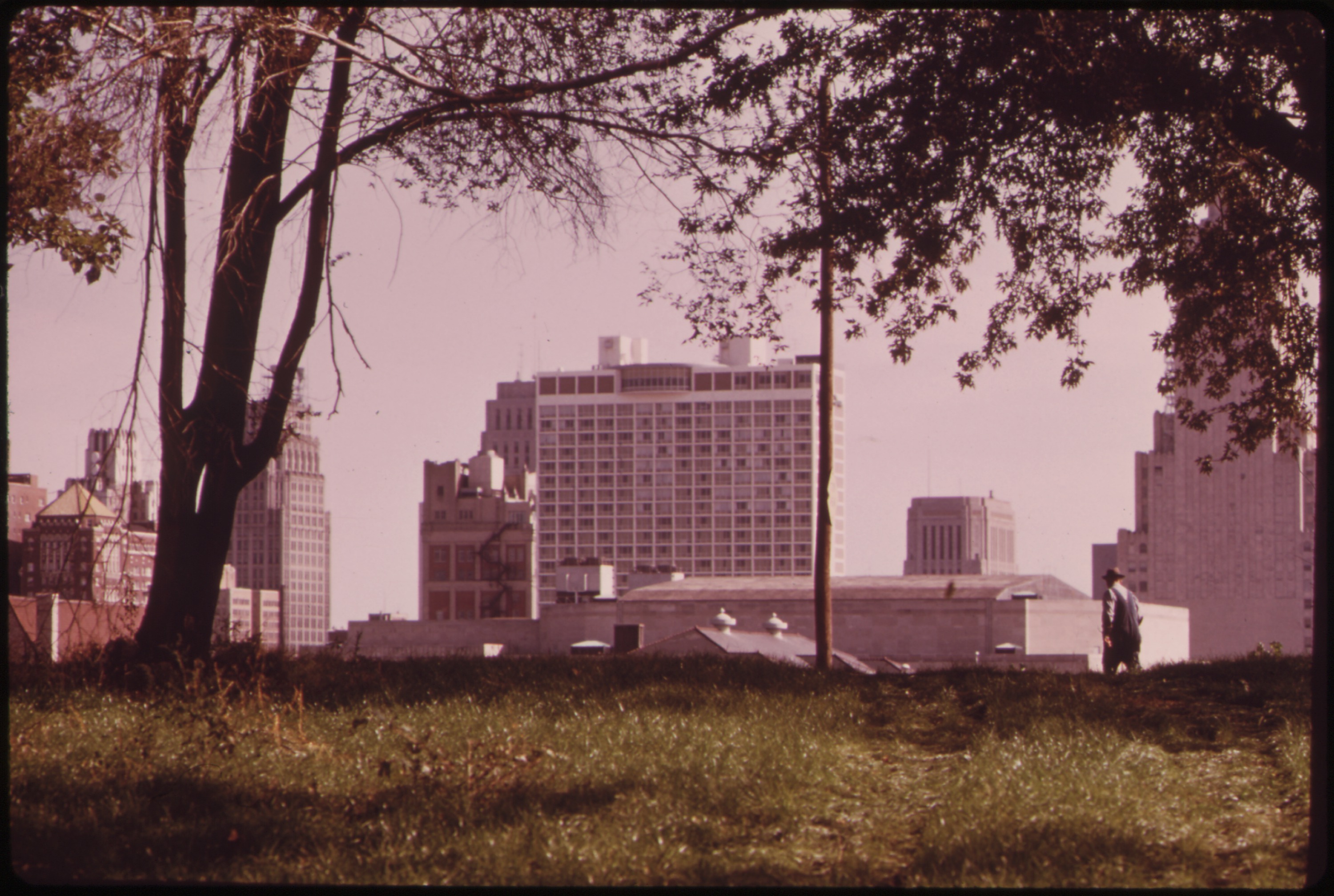
Mulky Square is a neighborhood in the west side of Kansas City, an area of low-income dwellings. I-635 will cut right through Mulky Square, which is already isolated by railroad yards on the west, I-70 on the north plus a 4-lane freeway on the east. Looking east toward downtown. Area in foreground was cleared for I-635: photo by Kenneth Paik (1940-1966) for the Environmental Protection Agency, October 1973 (US National Archives)
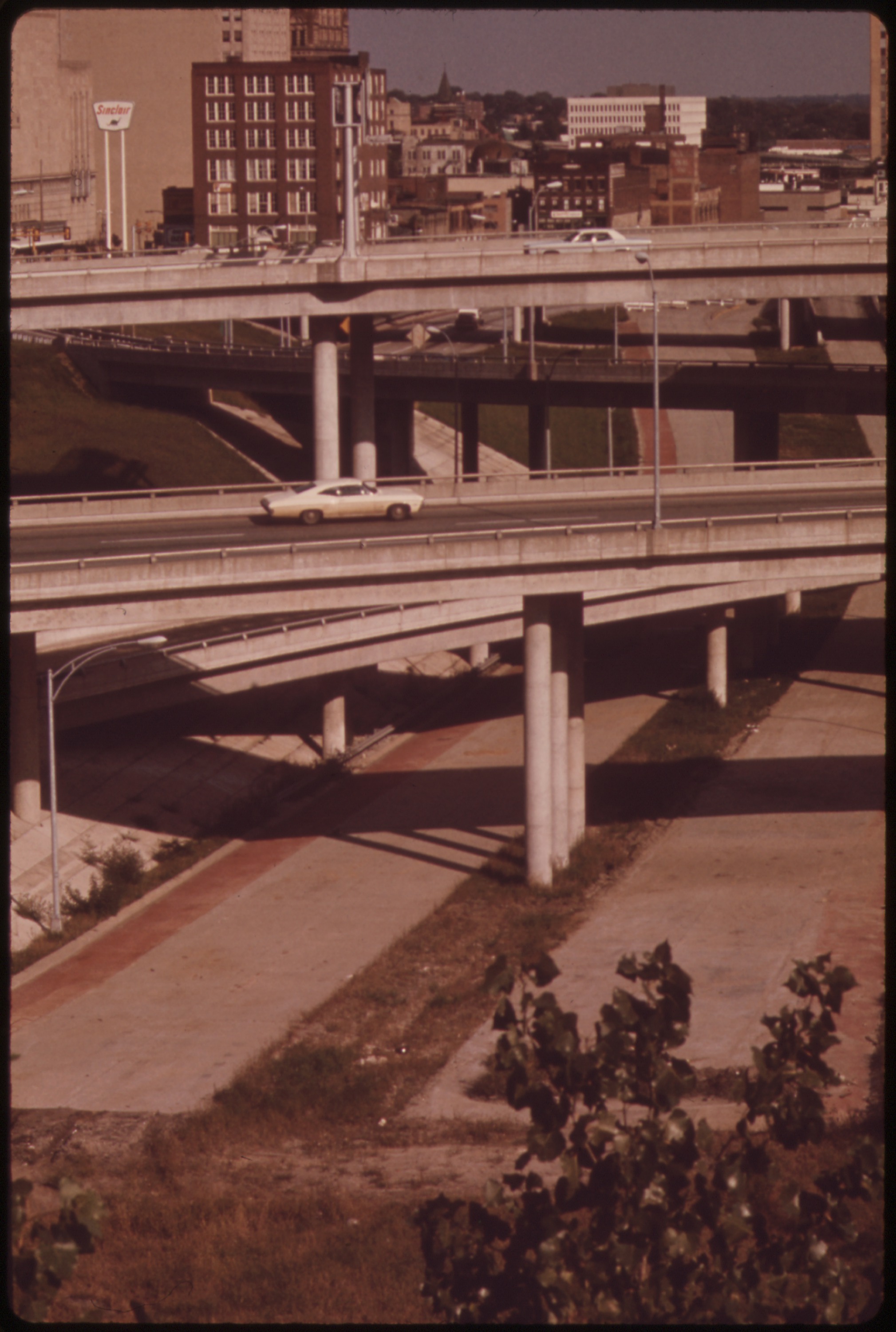
Mulky Square is a neighborhood in the west side of Kansas City, an area of low-income dwellings. I-635 will cut right through Mulky Square, which is already isolated by railroad yards on the west, I-70 on the north plus a 4-lane freeway on the east. I-635 will extend westward from this point: photo by Kenneth Paik (1940-1966) for the Environmental Protection Agency, October 1973 (US National Archives)

Mulky Square is a neighborhood in the west side of Kansas City, an area of low-income dwellings. I-635 will cut right through Mulky Square, which is already isolated by railroad yards on the west, I-70 on the north plus a 4-lane freeway on the east. Looking east toward downtown: photo by Kenneth Paik (1940-1966) for the Environmental Protection Agency, October 1973 (US National Archives)
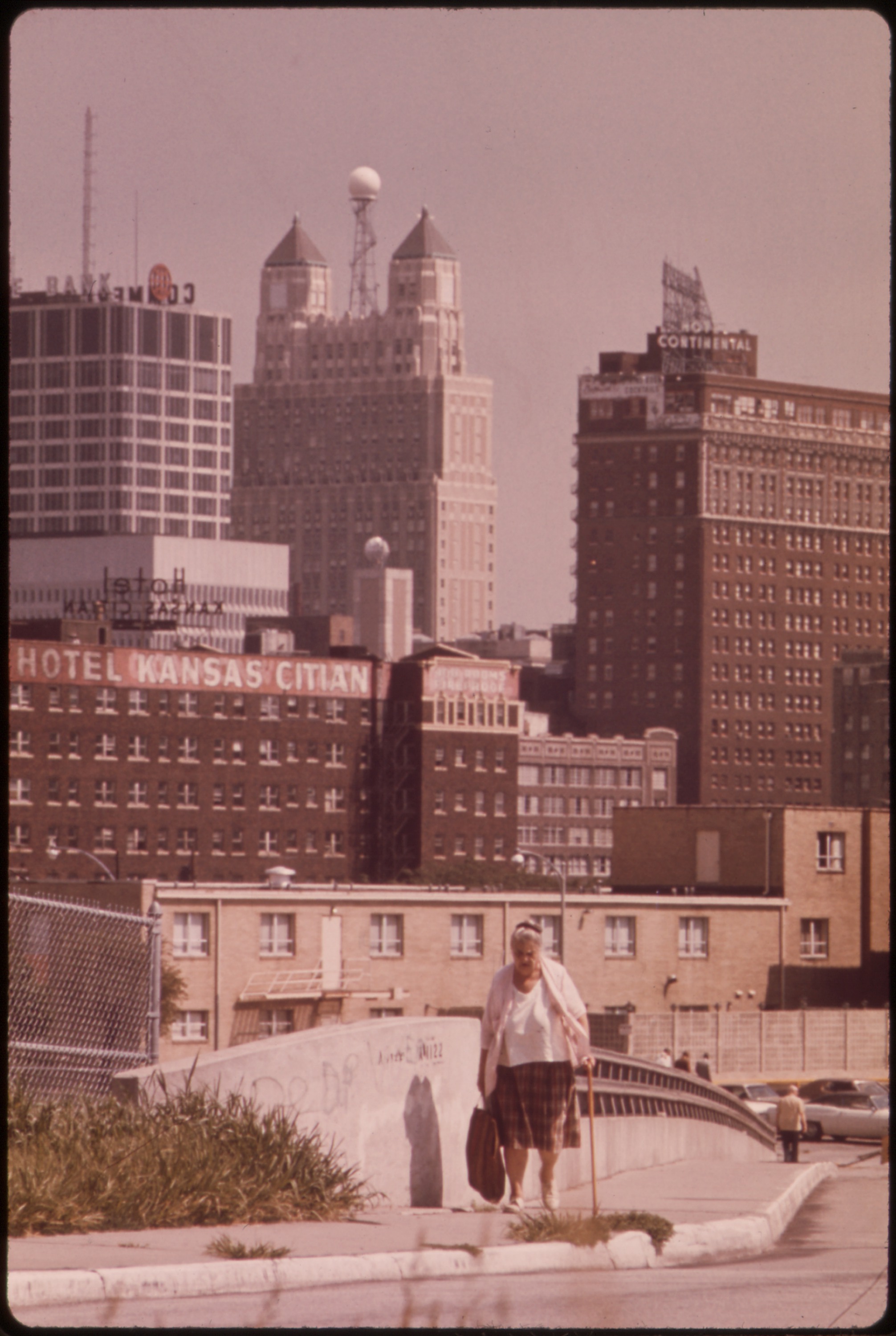
Mulky Square is a neighborhood in the west side of Kansas City, an area of low-income dwellings. I-635 will cut right through Mulky Square, which is already isolated by railroad yards on the west, I-70 on the north plus a 4-lane freeway on the east. I-635 will extend westward from this point. A resident returns from downtown by the 14th Street bridge, the only connection for people north of 23rd Street: photo by Kenneth Paik (1940-1966) for the Environmental Protection Agency, October 1973 (US National Archives)

Mulky Square is a neighborhood in the west side of Kansas City, an area of low-income dwellings. I-635 will cut right through Mulky Square, which is already isolated by railroad yards on the west, I-70 on the north plus a 4-lane freeway on the east. On Madison Street, above the area cleared for I-635, some businesses and residents plan to stay on: photo by Kenneth Paik (1940-1966) for the Environmental Protection Agency, October 1973 (US National Archives)

A couple of older residents of Mulky Square move down an empty street. The place where these men are standing will soon be part of a new interstate highway. About five blocks away (background) is the downtown area: photo by Kenneth Paik (1940-1966) for the Environmental Protection Agency, September 1973 (US National Archives)
VI...Demolition and Abandonment
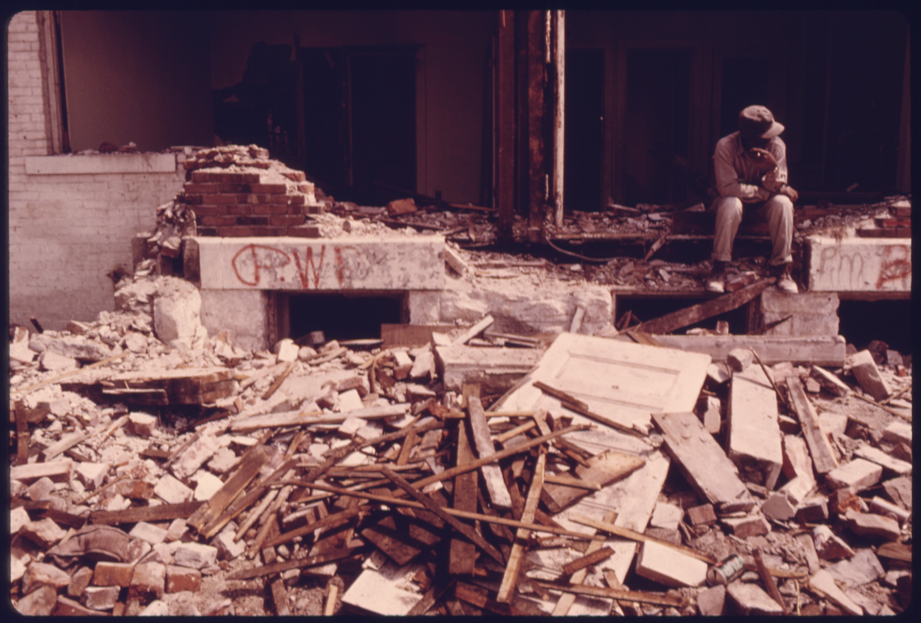
Member of a wrecking crew rests during demolition of hosing in the Mulkey Square area. Many of the low income residents living there were displaced by construction of an interstate highway through an area already isolated by roads and railroad tracks. It took one such family two months to find rental housing within their price range on the other side of town in Kansas City, Kansas. Moving was traumatic for many of the families: photo by Kenneth Paik (1940-1966) for the Environmental Protection Agency, May 1973 (US National Archives)
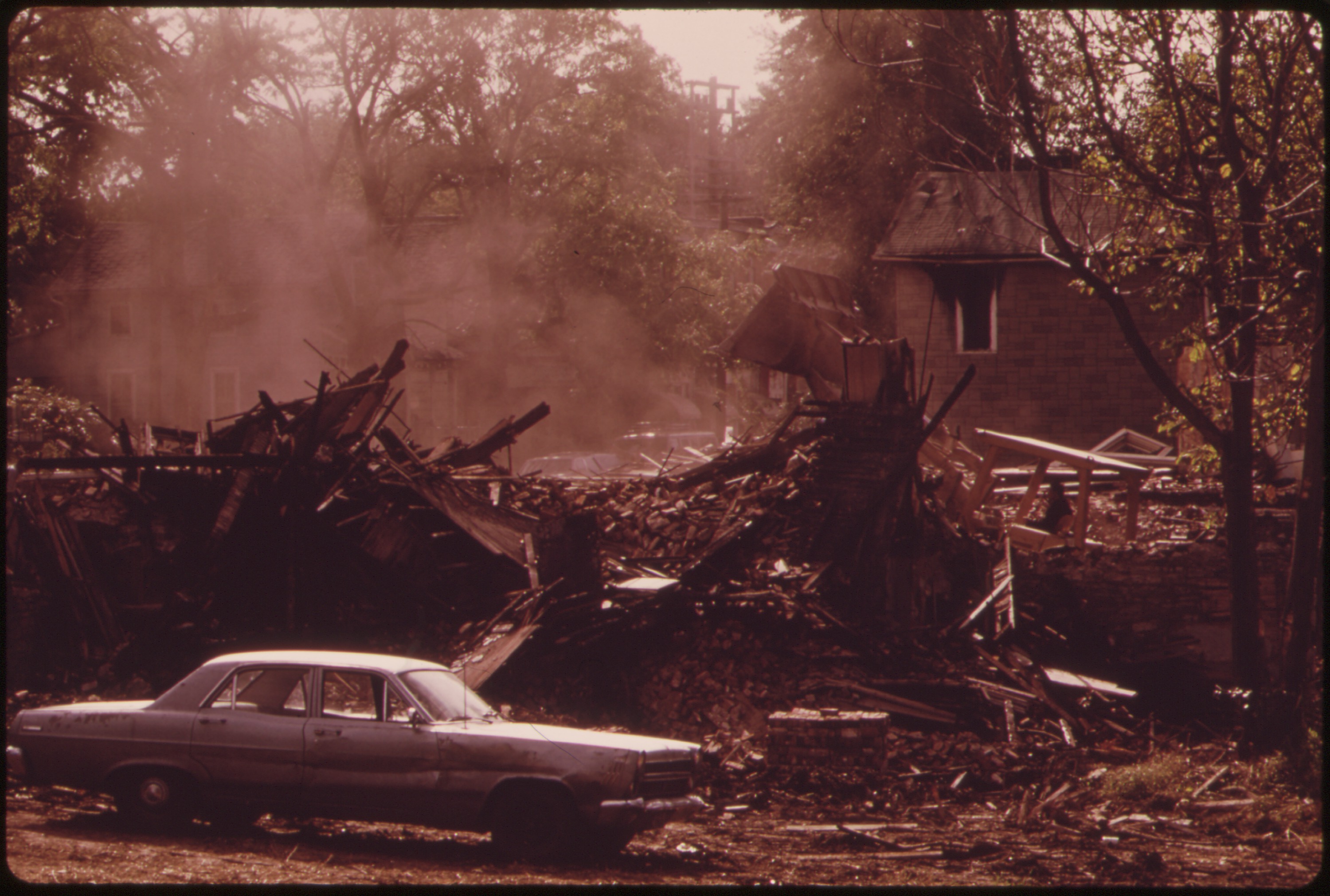
Mulky Square is a neighborhood in the west side of Kansas City, an area of low-income dwellings. I-635 will cut right through Mulky Square, which is already isolated by railroad yards on the west, I-70 on the north plus a 4-lane freeway on the east. Clearing for I-635: photo by Kenneth Paik (1940-1966) for the Environmental Protection Agency, October 1973 (US National Archives)

Mulky Square is a neighborhood in the west side of Kansas City, an area of low-income dwellings. I-635 will cut right through Mulky Square, which is already isolated by railroad yards on the west, I-70 on the north plus a 4-lane freeway on the east. Billy Watkins watches an apartment building come down in the 1600 block of Madison Street: photo by Kenneth Paik (1940-1966) for the Environmental Protection Agency, October 1973 (US National Archives)

Mulky Square houses, vacant now because they stand in the path of a new interstate highway (I-635). Mulky Square is an isolated west side neighborhood of low-income families. The highway means disruption on a major scale: photo by Kenneth Paik (1940-1966) for the Environmental Protection Agency, September 1973 (US National Archives)

Mulky Square houses, vacant now because they stand in the path of a new interstate highway (I-635). Mulky Square is an isolated west side neighborhood of low-income families. The highway means disruption on a major scale: photo by Kenneth Paik (1940-1966) for the Environmental Protection Agency, September 1973 (US National Archives)
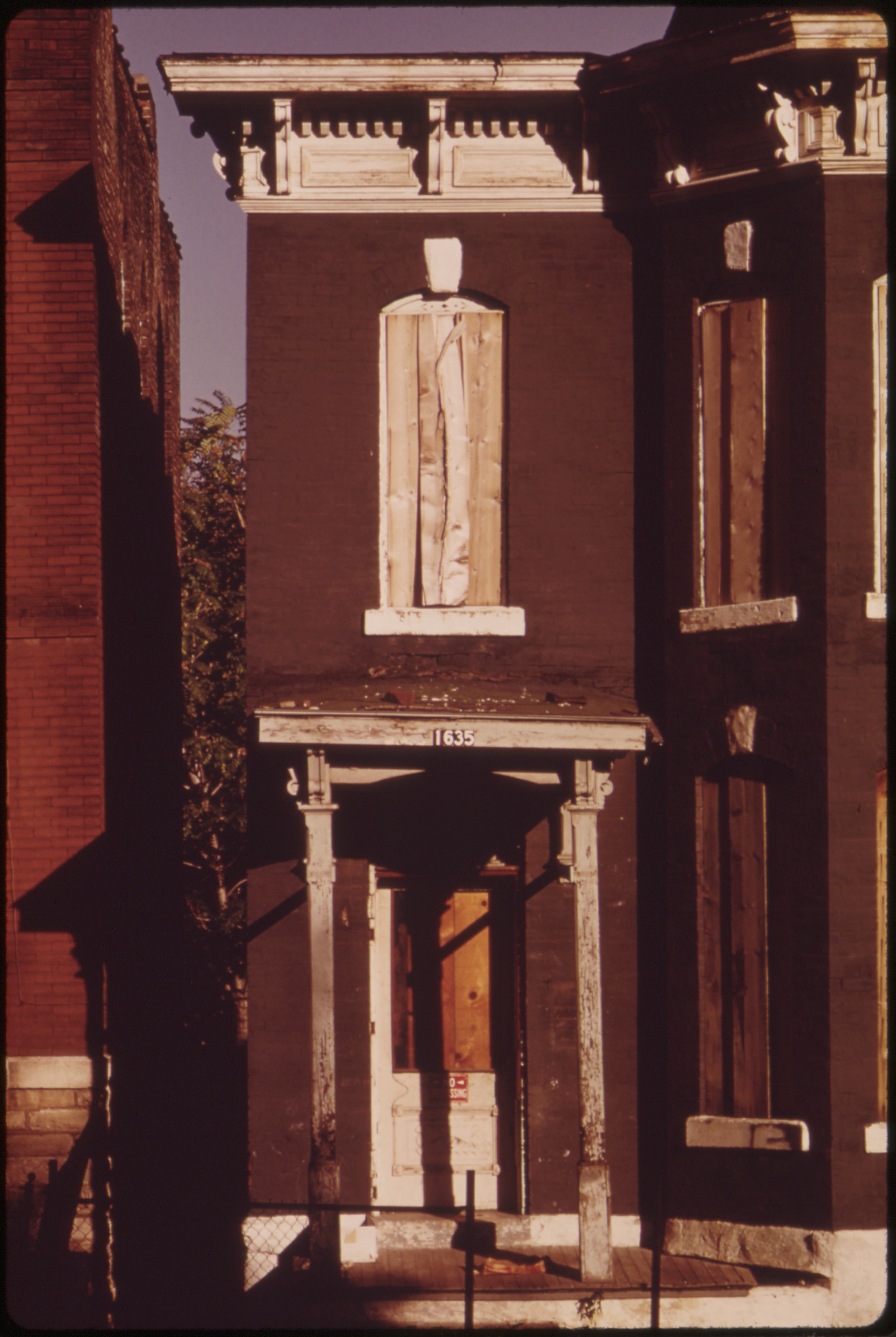
Mulky Square is a neighborhood in the west side of Kansas City, an area of low-income dwellings. I-635 will cut right through Mulky Square, which is already isolated by railroad yards on the west, I-70 on the north plus a 4-lane freeway on the east. Boarded-up building on Summit Street: photo by Kenneth Paik (1940-1966) for the Environmental Protection Agency, October 1973 (US National Archives)

Mulky Square is a neighborhood on the west side of Kansas City, an area of low-income dwellings. I-635 will cut right through Mulky Square, which is already isolated by railroad yards on the west, I-70 on the north and I-35 plus a 4-lane freeway on the east. Buildings are being closed down: photo by Kenneth Paik (1940-2006) for the Environmental Protection Agency, October 1973 (US National Archives)

Mulky
Square, an isolated, low-income area on the city's west side, is soon
to be torn up to make way for a new interstate highway. Many houses
stand vacant. A part of this building is still occupied by a family:
photo by Kenneth Paik (1940-1966) for the Environmental Protection
Agency, September 1973 (US National Archives)
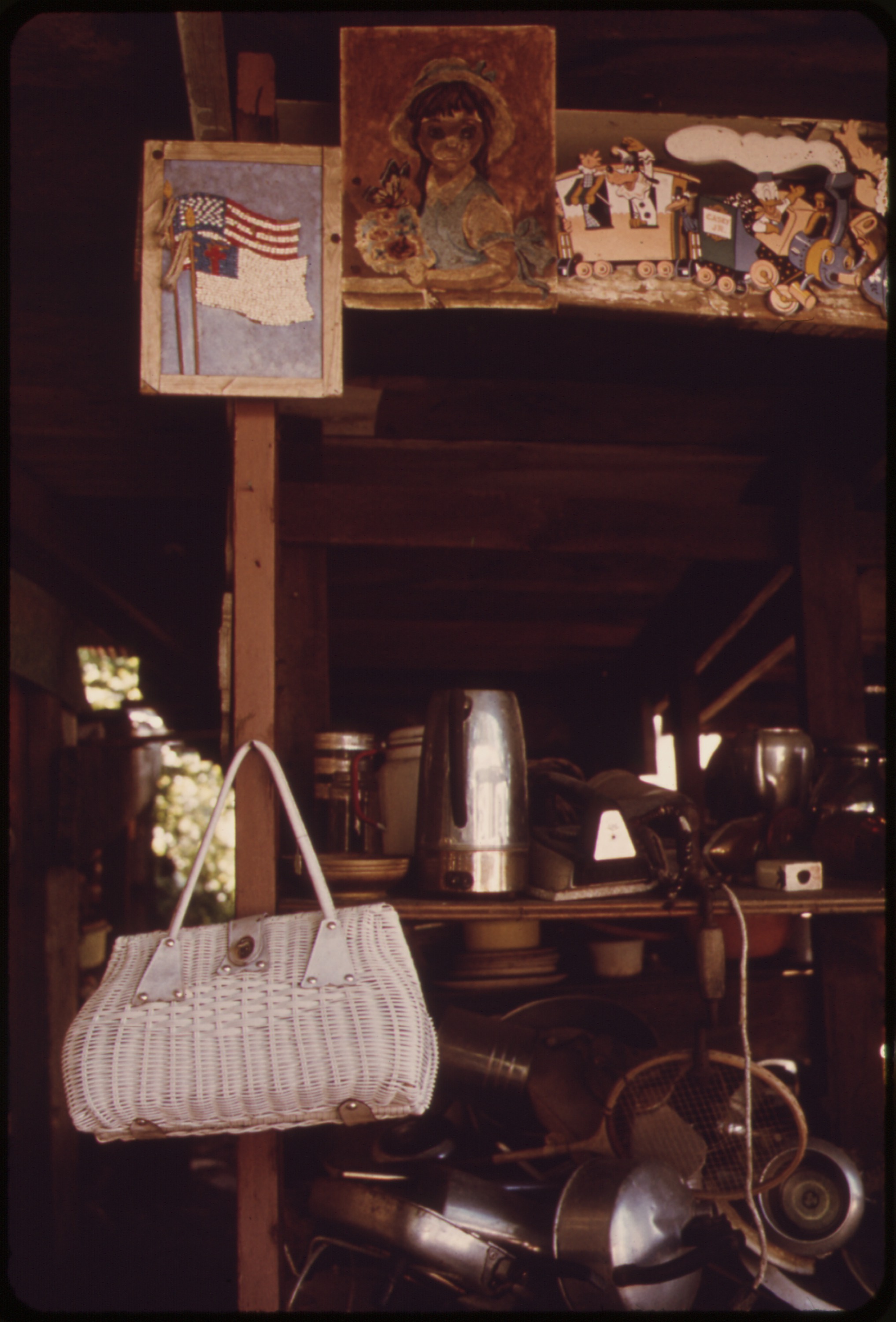
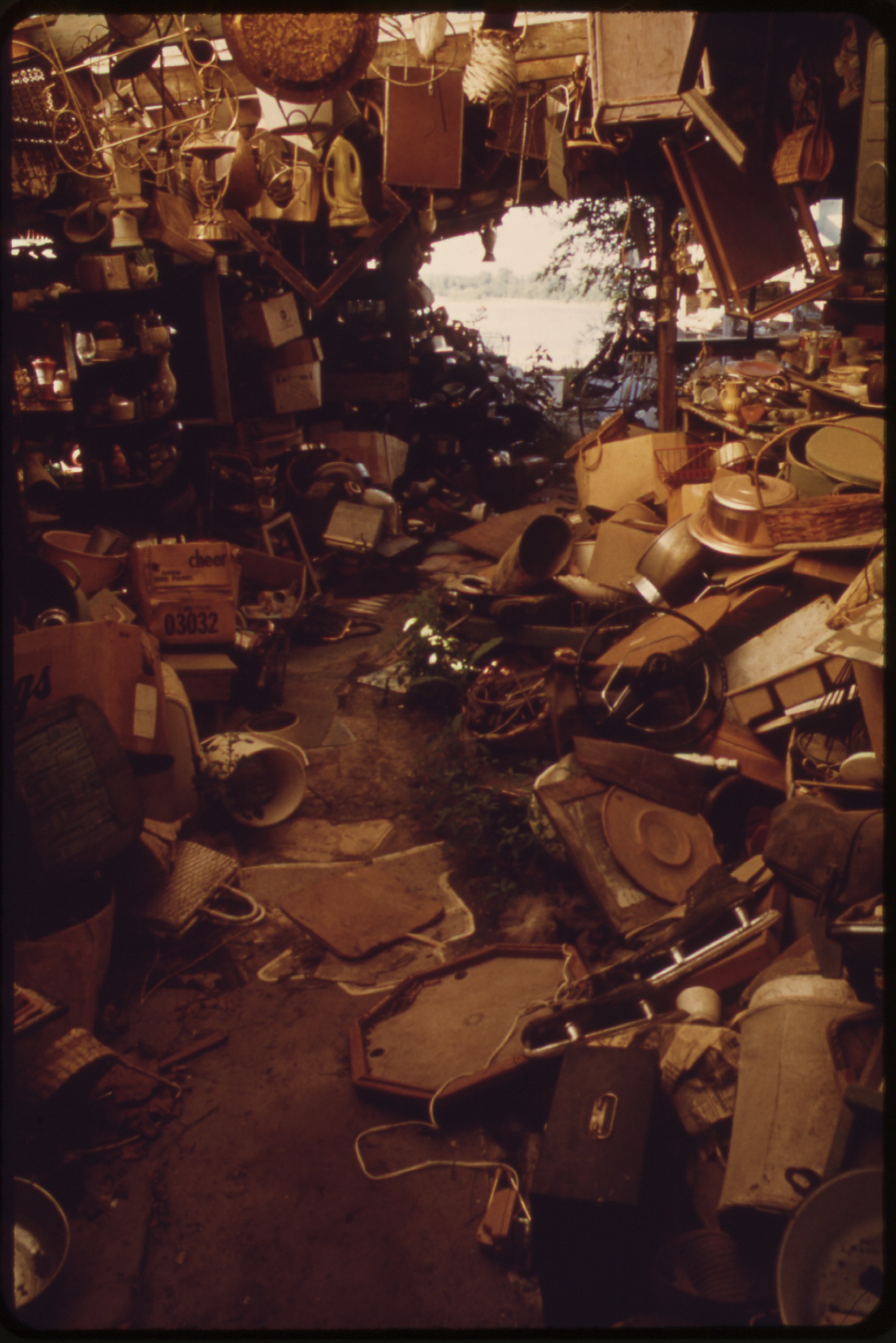
VII...Junkyard America: In a broken doll's eyes
The
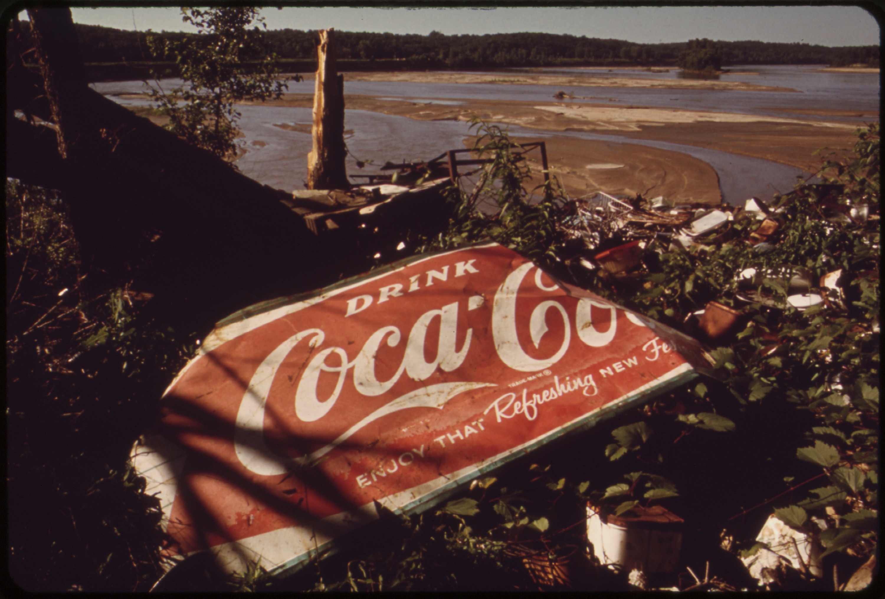
owner of this huge junk shop on the Kansas River in Bonner Springs died
in 1971. Now there is only the river and the junk; each day the river
claims a small part: photo by Kenneth Paik (1940-2006) for the Environmental Protection Agency, June 1973 (US National Archives)
Time Lapse
Each day, a
small part
of a whole lot
of yesterday
twilight
in the whites
of the broken
doll's eyes

A broken doll's face by the river edge -- silent commentary on man's use of nature as a junkyard. Near the 7th street bridge on the Kansas River, Kansas City: photo by Kenneth Paik (1940-2006) for the Environmental Protection Agency, October 1973; image by Queeg, October 2011 (US National Archives)

A broken doll's face by the river edge -- silent commentary on man's use of nature as a junkyard. Near the 7th street bridge on the Kansas River, Kansas City: photo by Kenneth Paik (1940-2006) for the Environmental Protection Agency, October 1973 (US National Archives)
VIII...Now there is only the river and the junk

The owner of this huge junk shop on the Kansas River in Bonner Springs died in 1971. Now there is only the river and the junk; each day the river claims a small part: photo by Kenneth Paik (1940-2006) for the Environmental Protection Agency, June 1973 (US National Archives)
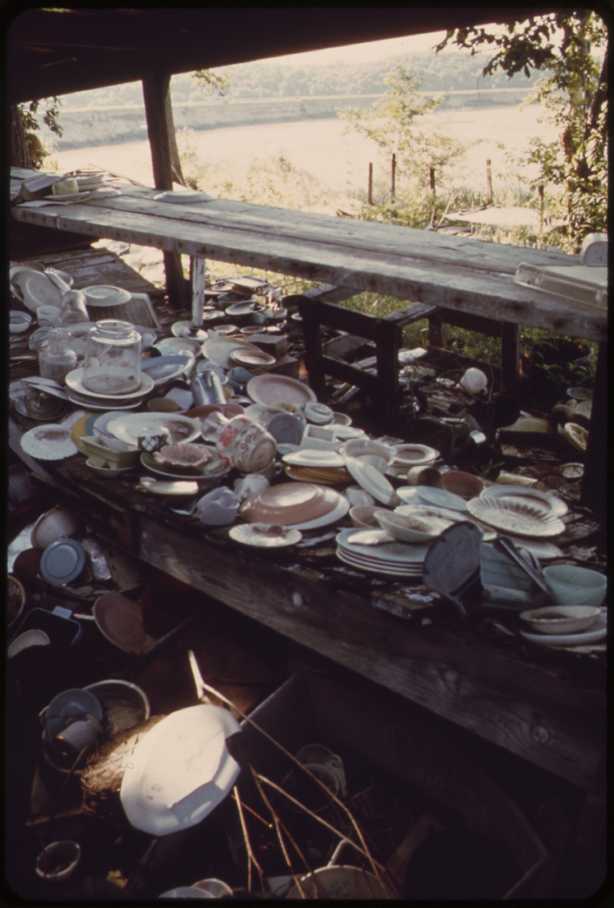
The owner of this huge junk shop on the Kansas River in Bonner Springs died in 1971. Now there is only the river and the junk; each day the river claims a small part: photo by Kenneth Paik (1940-2006) for the Environmental Protection Agency, June 1973 (US National Archives)
The owner of this huge junk shop on the Kansas River in Bonner Springs died in 1971. Now there is only the river and the junk; each day the river claims a small part: photo by Kenneth Paik (1940-2006) for the Environmental Protection Agency, June 1973 (US National Archives)

The owner of this huge junk shop on the Kansas River in Bonner Springs died in 1971. Now there is only the river and the junk; each day the river claims a small part: photo by Kenneth Paik (1940-2006) for the Environmental Protection Agency, June 1973 (US National Archives)

The owner of this huge junk shop on the Kansas River in Bonner Springs died in 1971. Now there is only the river and the junk; each day the river claims a small part: photo by Kenneth Paik (1940-2006) for the Environmental Protection Agency, June 1973 (US National Archives)
The owner of this huge junk shop on the Kansas River in Bonner Springs died in 1971. Now there is only the river and the junk; each day the river claims a small part: photo by Kenneth Paik (1940-2006) for the Environmental Protection Agency, June 1973 (US National Archives)

The owner of this huge junk shop on the Kansas River in Bonner Springs died in 1971. Now there is only the river and the junk; each day the river claims a small part: photo by Kenneth Paik (1940-2006) for the Environmental Protection Agency, June 1973 (US National Archives)

The owner of this huge junk shop on the Kansas River in Bonner Springs died in 1971. Now there is only the river and the junk; each day the river claims a small part: photo by Kenneth Paik (1940-2006) for the Environmental Protection Agency, June 1973 (US National Archives)

The owner of this huge junk shop on the Kansas River in Bonner Springs died in 1971. Now there is only the river and the junk; each day the river claims a small part: photo by Kenneth Paik (1940-2006) for the Environmental Protection Agency, June 1973 (US National Archives)

The owner of this huge junk shop on the Kansas River in Bonner Springs died in 1971. Now there is only the river and the junk; each day the river claims a small part: photo by Kenneth Paik (1940-2006) for the Environmental Protection Agency, June 1973 (US National Archives)

12rh Street in the early morning looking south toward the Kansas River. Junk cars are being sold to a local factory which processes scrap metal: photo by Kenneth Paik (1940-2006) for the Environmental Protection Agency, June 1973 (US National Archives)

Automobile junkyard on the north bank of the Kansas River between the 12th and 18th Street bridges: photo by Kenneth Paik (1940-2006) for the Environmental Protection Agency, May 1973 (US National Archives)

Inner city viaduct area where railroad and auto bridges across the Missouri River join Kansas City, Kansas with Kansas City, Missouri. This is the point where the Kansas River and the Missouri River come together: photo by Kenneth Paik (1940-2006) for the Environmental Protection Agency, May 1973 (US National Archives)
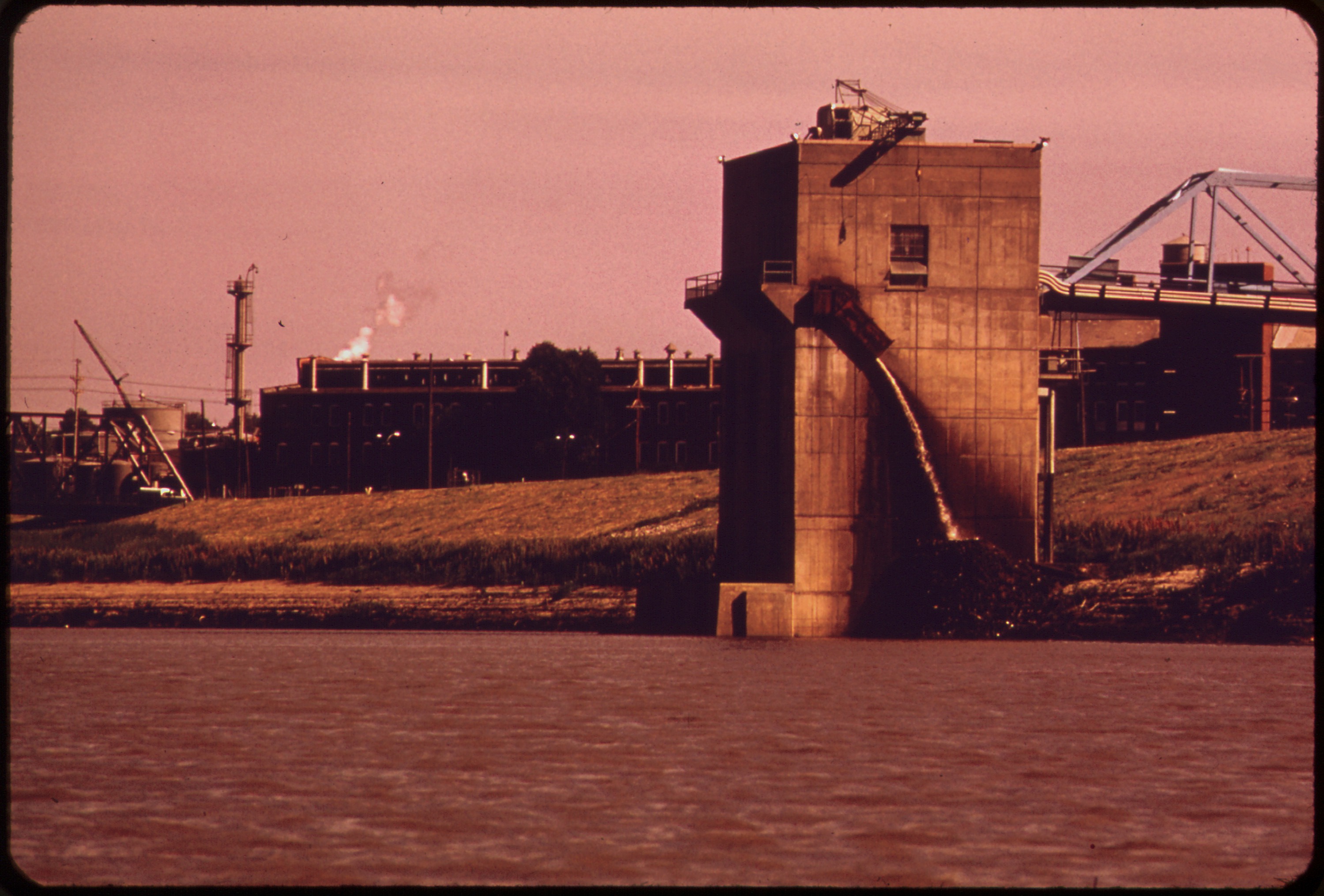
Industry just upstream from the 18th Street bridge discharges waste from water filtering process into the Kansas River, Kansas City: photo by Kenneth Paik (1940-2006) for the Environmental Protection Agency, June 1973 (US National Archives)
The photographer

Ken Paik (1940-2006) covers the NAIA Basketball Tournament as a photographer with the Kansas City Star: photo by Dale Monaghen, 19 March 1974; posted 27 November 2006 (via Dale Monaghen)

Ken Paik (1940-2006) covers the NAIA Basketball Tournament as a photographer with the Kansas City Star: photo by Dale Monaghen, 19 March 1974; posted 27 November 2006 (via Dale Monaghen)

Ken Paik (1940-2006) covers a fire at 12th and Central Ave. in Kansas City, Missouri as a photographer with the Kansas City Star: photo by Dale Monaghen, April 1974; posted 27 November 2006 (via Dale Monaghen)


Ken Paik (1940-2006) covers the arrival of Vietnamese refugees at Fort Chaffee, Arkansas as a photographer with the Kansas City Star: photo by Dale Monaghen, May 1975; posted 27 November 2006 (via Dale Monaghen)

Ken Paik (1940-2006) covers the
arrival of Vietnamese refugees at Fort Chaffee, Arkansas as a photographer with the Kansas City Star: photo by Dale Monaghen, May 1975; posted 27 November 2006 (via Dale Monaghen)


10 comments:
There are some great photos here, Tom. Thanks for sharing them. Reminded me immediately of Solnit's article on Detroit. And the dolls..takes me back to that scene from one of the old Planet of the Apes films when they find a doll in the mud. Looking back on all that has been abandoned, all that has been accumulated and thrown away, you wonder what anyone would make of human civilisation: a waste, or the trace of some beautiful stories around each object?
K, what's worse than the national contagion of "urban development" -- which systematically demolished tens of thousands of liveable if well-used structures in the cities -- was/is the freeway wastelands which have replaced them. For me what's most affecting here are the shots of old people trying to get on somehow with their rickety shopping contraptions in neighborhoods that are literally coming down around them. The subsequent suburban tract sprawls and malls and megastores that were to contain a bright synthetic future have left us with a hazy, polluted coast-to-coast concrete parking-lot that bears little trace of what Raymond Williams once called "knowable community", a term now overborne alternately by nostalgia and memory loss.
The photographer here, Kenneth Paik, was Korean by birth, a veteran of the Korean Marines, who became a respected photojournalist for a number of city papers, in Kansas City, later Baltimore, and also went on to work internationally in Africa, among other places. His success in getting up so close with his common subjects here is a result in part of his familiarity with the region, where he'd been working steadily on journalistic assignments, and in part of his necessary ability to see the American Heartland, so called, with an outsider's objective eye.
This assignment for the EPA came from the Documerica project, a short-lived, extremely interesting early 70's photographic survey designed after the model of the terrific Farm Security Administration surveys of the Depression era. The project survived only the early years of the decade. There's been nothing like it since.
heartbreaking, poem and photos Tom...when I moved back to Jersey after forty years away I didn't know how to get around to nearby towns from where I grew up because there are so many "freeways" etc. cutting through old neighborhoods and the streets that connected them etc. ...isolating and atomizing what once were strong bonds etc.... the obvious but still tragic in my eyes and of course they mostly destroyed the poorer neighborhoods etc.
Yes, that picture with the old man bent over double, with his trolley of things (soup cans?)is wonderful, as is the one of the quiet street under leafy shade on what must be a Saturday afternoon.
Yep, the liveable, worn-out, perhaps even shoddy habitat vs the abstract plan of the designers and engineers. I think Sennett was right when he wrote that roads (highways) are just about getting from A to B (but there's no 'B' there when you get there-to paraphrase G. Stein). Isn't all the hype about the supposed connectivity of the internet highway really just the same thing? Speed, movement, restlessness, freedom..but to what end, what purpose (except it's all very convenient for the economic system).
Strange, but where I used to live (S. Wales) was also a bit "run down", although we never really thought of it like that when we were kids.
Tom, there's this great line in Hugh Brody's 'The Other Side of Eden' when Brody takes a Native American to Essex to show him what he thinks is closer to Nature (away from the city..since you mention Raymond Williams). But all the 'Red Man' could say was: "it's so built up!".
Maybe that's what we're witnessing here: the break down of an agro-industrial civilisation?
Khair..thanks again for pointing us to these wonderful, sad pictures.
Best wishes,
K.
The Pretenders - My city was gone
about Akron,OH - live version
https://www.youtube.com/watch?v=pvAYGz6Iwmc
Many thanks to all for adding useful testimony and text to help us appreciate Ken Paik's portfolio.
"...isolating and atomizing what once were strong bonds"..."the breakdown of an agro-industrial civilisation"..."My city was gone..."
The process by which American countryside, with its myriad local variations in landscape, social and economic presence, and relative human habitability, was transformed in the second half of the twentieth century into a massive, more or less continuous industrial/ commercial strip, organized by capital accumulation and distribution, is writ small in the lives of the people Ken Paik photographs here.
Some historical context on the specific location Paik was documenting in Kansas City:
"...That meant that the cities became spatially enormous and far flung, geographically huge but with densities half that of the national urban average. In this regard, Kansas City was quite typical. Although not a deeply Southern city, it occupies the edge of Missouri’s southern inflected culture. By the 1970s, it had become five times as large in area as it had been in the 1940s. The spread was accomplished, as it was across the Sunbelt, by annexation. The “growth” in southern cities was largely a matter of retaining the tax base northern cities lost to their suburbs. Mild climate, relative lack of industrial blight and, anti-union right to work laws lured businesses from the North.
"Two enormous effects of this were visited upon Mulkey Square. First, highways became the key determinant of growth, necessary to the functioning of the sprawling metropolis and thus heavily lobbied for by corporations and municipal governments, often in partnership. And, with high earning management positions occupied mostly by incoming non Southern professionals, uneducated native Southerners were left to the low wage jobs of the marginal manufacturing industries like biscuitmaking. In many ways, Kansas City experienced some of the major trends of the Northeast, such as the emptying of downtown districts in favor of suburbs, a great in migration of African Americans from the deeper South, the destruction of low income inner city neighborhoods, and the loss of what manufacturing industry it had (mostly stockyards and meatpacking) over the course of the second half of the twentieth century. But here massive highway construction plans left the dislocated poor to their own devices, as Kansas City, unlike northeastern urban centers, never engaged significantly in the construction of public housing."
[continues:]
"By 1973 the buildings of Mulkey Square had clearly been neglected for years, but at one time the area was a prosperous early suburb of Kansas City. Built in the 1870s, the houses are large and exhibit styles designed to express a conservatively fashionable architectural sensibility. Ironically, their decorative elements indicated to a 1971 team of architectural surveyors that home ownership in Mulkey Square originally exemplified a 'best foot forward' attitude intended to 'create the best social impression possible.'
"By the 1970s, no such attitude of social impression is possible for the kinds of residents who live in Mulkey Square. The middle class began to move southward around 1917... With the departure of the middle class, banks stopped giving loans for the area and the houses were eventually subdivided and used as rooming houses. After World War II, with the area transformed into cheap, ill maintained rentals, the city constructed a new public housing project nearby and cut back on providing street repair and basic services. The middle class migration southward in Kansas City is particular to the city’s history and also contains a national story, in fact helped shape the national story of suburban expansion. Middle class migration was spurred by the construction of Country Club Plaza, the first shopping center planned around the automobile. The brainchild of J.C. Nichols, it was dubbed 'Nichols’ Folly'; when first proposed because city fathers were convinced people would never venture that far outside the established city limits. At the time of his purchase in 1915, the streetcar lines ended at 47th Street (Mulkey Square is at 51st) and Nichols’ parcel began at 51st. But Nichols predicted the influence of the automobile, and in fact encouraged it. He created a planned residential development around the shopping plaza that included eight filling stations, parking spaces in front of the shops, and a private garage for each home.
"Not only did the affluent middle classes move beyond city limits, they shifted the heart of the city from downtown to the Country Club Plaza district, where it remains today, and paved the way for further suburban expansion."
-- Barbara Lynn Shubinski, 2009
I lived in this area! Actually, the home we lived in is shown in a few of the pictures. These pictures brought me back to a place I thought I would never see again.
Thank you!
Jeraldine Perala
Thank you, Geraldine.
You are the reader this post has been waiting for. Continuity, completing the circle...
Post a Comment