.

Sparse vegetation in the gypsum dunes of White Sands National Monument: photo by Daniel Schwen, 4 April 2004

Dunes at White Sands National Monument: photo by Jennifer Wilbur, 17 December 2004

White Sands, New Mexico: photo by davebluedevil, 18 May 2003

Military personnel at White Sands National Monument: photo by Daniel Schwen, 4 April 2004

ROAD CLOSED sign on US Route 70 and 82, posted during missile testing at White Sands Range, White Sands National Monument: photo by US National Park Service, 2007 (USNPS)

Trinity Site historical marker along US 380: photo by Df206, 1 November 2008

Scale model of first atomic bomb detonated at Trinity Site: photo by White Sands Missile Range Museum; image by Dickbauch, 26 January 2005
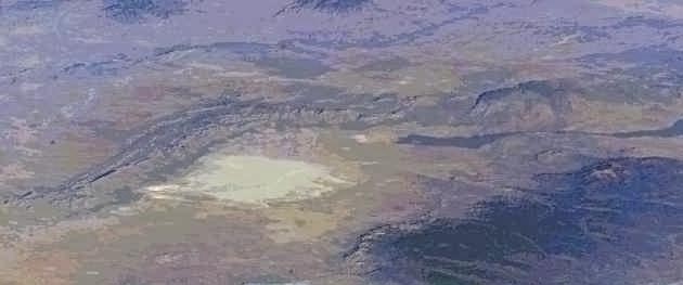
Aerial view showing the Jornada del Muerto Desert region, with dry lake, Tularosa basin, New Mexico: astronaut photo by NASA, 29 December 2003; image by Earth Sciences and Image Analysis, NASA-Johnson Space Center (NASA)

Aerial view showing the Carrizozo Malpais as the long dark steak across the bottom half of the image. The red arrowhead marks the location of Trinity site. Sierra Blanca is visible at lower right, and the low ridge towards the top of the photo is the Oscura Mountains: astronaut photo, taken from an altitude of 198 miles, by NASA, 29 December 2003; image by Earth Sciences and Image Analysis, NASA-Johnson Space Center (NASA)

The route of the Jornada del Muerto [Journey of the Dead Man] Trail, New Mexico: image by Thaddeus P. Bejnar, 4 May 2006, based on US Bureau of Land Management maps of El Camino Real de Tierra Adentro and the Jornada del Muerto
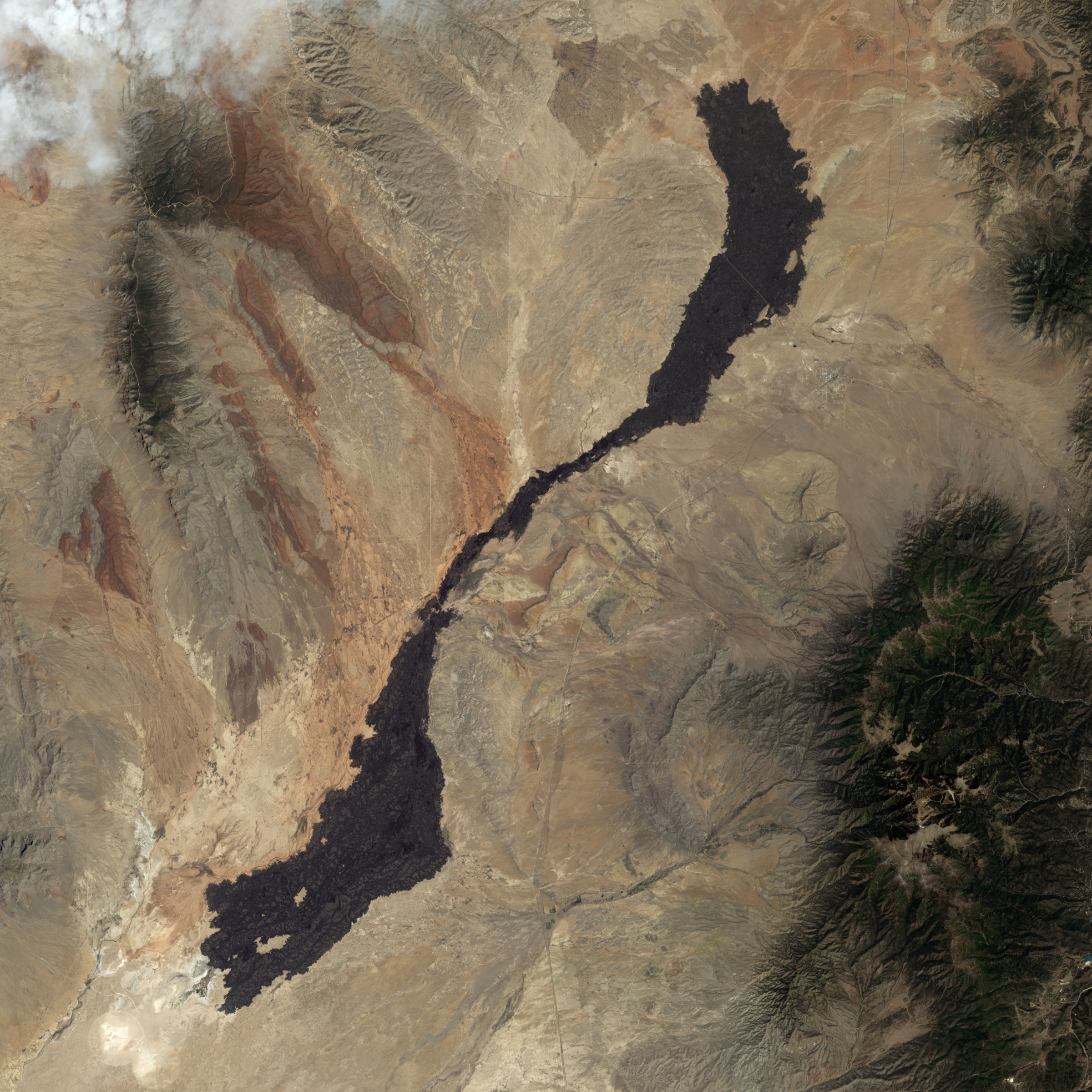
Carrizozo Malpais lava flow, New Mexico. The lava flow varies in width from 1 kilometre along its slender neck to 5 kilometres at either end. Within its curving borders, the Carrizozo lava flow has a uniform dark colour, thanks to its basalt content. Basalt tends to flow easily, and this lava flow is described as a pahoehoe flow -- advancing through lobes or toes that separate from a cooled crust. The high point on Carrizozo is Little Black Peak. This is a cinder cone -- a simple type of volcano made from congealed droplets and blobs of lava that erupted from a single vent. Near the lava flow’s north-eastern end is the town of Carrizozo. Both south-east and north-west of the lava flow, the landscape appears dark, but this results not from volcanic rocks but from vegetation-lined hills: image by Jesse Allen/NASA Earth Observatory, using data provided by the US Geological survey Landsat-7 satellite, 30 July 2009 (NASA)

View north across Malpais lava field to nested spatter cones of the Jornada del Muerto Volcano: photo by Cory Boehne, 1 August 2010


3 comments:
Tom,
Besides the shadow of a burning tree
Little feet in dry sand,blowing away..
with what remains of the wind...
How white will we let the sand be ?
and for how long ?
It seems funny to me to say "thank you" for this, but thank you. Mysterious, disturbing and makes me sad.
Spending a bit of time in those parts as a stranger of an "impressionable age", one came away with indelible memories of a beautiful, arid, wasted landscape marked as if with an invisible fallout plume by the record of ghostly human historical presences and deeds. The Trail of the Dead Man may have been named after a particular unfortunate traveller, but there is so much in a name. You can see it from Space.
Post a Comment