
View from living quarters at 730 West Winnebago Street, looking toward alley, Milwaukee, Wisconsin: photo by Carl Mydans, April 1936 (Farm Security Administration/Office of War Information Collection, Library of Congress)

Junk, with living quarters close by, Milwaukee, Wisconsin: photo by Carl Mydans, April 1936 (Farm Security Administration/Office of War Information Collection, Library of Congress)
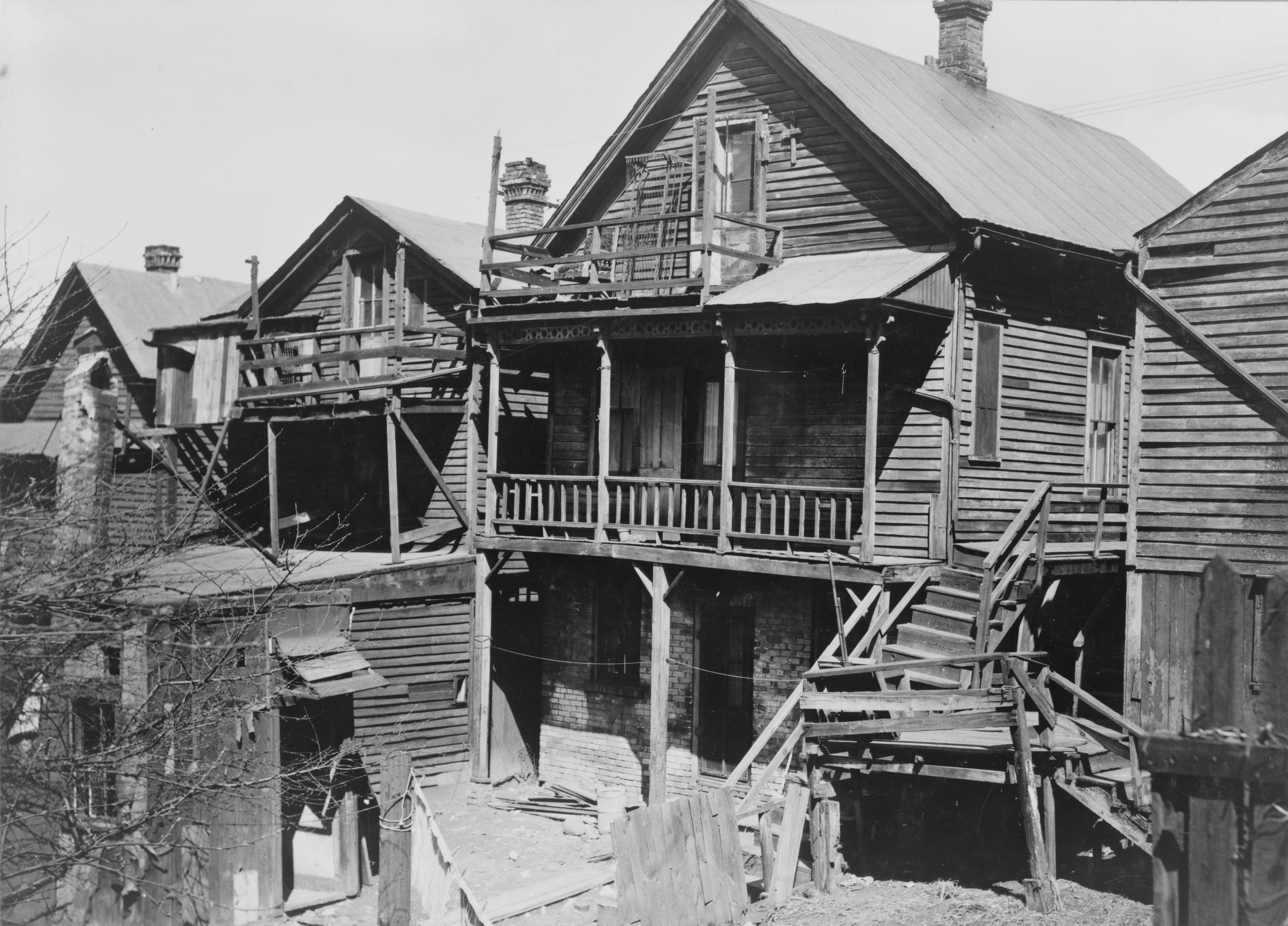
Slums in Milwaukee: photo by Carl Mydans, April 1936 (Farm Security Administration/Office of War Information Collection, Library of Congress)

Group of houses at Detroit and Van Buren Streets, near electric railroad, Milwaukee, Wisconsin: photo by Carl Mydans, April 1936 (Farm Security Administration/Office of War Information Collection, Library of Congress)


Labor Day, Greendale, Wisconsin: photo by John Vachon, September 1939 (Farm Security Administration/Office of War Information Collection, Library of Congress)

Hartford, Wisconsin, Fourth of July: photo by John Vachon, 4 July 1941 (Farm Security Administration/Office of War Information Collection, Library of Congress)

Hartford, Wisconsin, Fourth of July: photo by John Vachon, 4 July 1941 (Farm Security Administration/Office of War Information Collection, Library of Congress)

Advertising, Plymouth, Wisconsin: photo by John Vachon, July 1941 (Farm Security Administration/Office of War Information Collection, Library of Congress)

Sign on US 41, Kenosha County, Wisconsin: photo by John Vachon, July 1941 (Farm Security Administration/Office of War Information Collection, Library of Congress)

Sign on US 41, Kenosha County, Wisconsin: photo by John Vachon, July 1941 (Farm Security Administration/Office of War Information Collection, Library of Congress)

Sign on US 41, Kenosha County, Wisconsin: photo by John Vachon, July 1941 (Farm Security Administration/Office of War Information Collection, Library of Congress)

Sign on US 41, Kenosha County, Wisconsin: photo by John Vachon, July 1941 (Farm Security Administration/Office of War Information Collection, Library of Congress)

Sign on US 41, Kenosha County, Wisconsin: photo by John Vachon, July 1941 (Farm Security Administration/Office of War Information Collection, Library of Congress)

Barrels of powdered milk at condensary, Antigo, Wisconsin: photo by John Vachon, July 1941 (Farm Security Administration/Office of War Information Collection, Library of Congress)
Lorine Niedecker: Poet's work
Grandfather
advised me:
Learn a trade.
Learn a trade.
I learned
to sit at desk
and condense.
No layoff
from this
condensery.
Lorine Niedecker ((b. Fort Atkinson, Wisconsin, 1903 d. Fort Atkinson, Wisconsin, 1970): Poet's work from Origin II.6, 1963

Barrels of powdered milk at milk condensing plant, Antigo, Wisconsin: photo by John Vachon, August 1941 (Farm Security Administration/Office of War Information Collection, Library of Congress)

Abandoned farm and snow fence, Wisconsin: photo by John Vachon, September 1939 (Farm Security Administration/Office of War Information Collection, Library of Congress)
Lorine Niedecker: Mother Goose Is On Relief
The land of four o'clocks is here

the five of us together

      looking for our supper.

Half past endive, quarter to beets,

seven milks, ten cents cheese,

      lost, our land, forever.
Lorine Niedecker (b. Fort Atkinson, Wisconsin, 1903 d. Fort Atkinson, Wisconsin, 1970): "The land of four o'clocks is here" from Mother Geese in New Directions 1, 1936

Baby of Daisy Heath, near Black River Falls, Wisconsin. Mrs. Heath lives alone on two acres of land: photo by Russell Lee, June 1937 (Farm Security Administration/Office of War Information Collection, Library of Congress)

Alonzo Heath with two of his children. He is a farmer near Black Falls, Wisconsin: photo by Russell Lee, June 1937 (Farm Security Administration/Office of War Information Collection, Library of Congress)

Barn on Alonzo Heath's cut-over farm near Black River Falls, Wisconsin: photo by Russell Lee, June 1937 (Farm Security Administration/Office of War Information Collection, Library of Congress)

Backporch of Henry McPeak's house, Black River Falls, Wisconsin: photo by Russell Lee, June 1937 (Farm Security Administration/Office of War Information Collection, Library of Congress)

Art Simplot and his family in front of their house near Black River Falls, Wisconsin: photo by Russell Lee, June 1937 (Farm Security Administration/Office of War Information Collection, Library of Congress)

Art Simplot's children, near Black River Falls, Wisconsin: photo by Russell Lee, June 1937 (Farm Security Administration/Office of War Information Collection, Library of Congress)

Art Simplot's sons in the kitchen and washroom of their house near Black River Falls, Wisconsin: photo by Russell Lee, June 1937 (Farm Security Administration/Office of War Information Collection, Library of Congress)

Art Simplot's youngest child in her home at Black River Falls, Wisconsin: photo by Russell Lee, June 1937 (Farm Security Administration/Office of War Information Collection, Library of Congress)

Abandoned farm buildings near New Lisbon, Wisconsin: photo by Russell Lee, June 1937 (Farm Security Administration/Office of War Information Collection, Library of Congress)

Abandoned farm buildings near New Lisbon, Wisconsin: photo by Russell Lee, June 1937 (Farm Security Administration/Office of War Information Collection, Library of Congress)

Barn on the Bodray farm, Tipler, Wisconsin: photo by Russell Lee, May 1937 (Farm Security Administration/Office of War Information Collection, Library of Congress)

Abandoned farm on the road from Tipler to Long Lake, Wisconsin: photo by Russell Lee, May 1937 (Farm Security Administration/Office of War Information Collection, Library of Congress)

Bed in William Howell's home near Tipler, Wisconsin. He is a cut-over farmer on relief: photo by Russell Lee, May 1937 (Farm Security Administration/Office of War Information Collection, Library of Congress)

Attic bedroom in Max Sparks's house near Long Lake, Wisconsin: photo by Russell Lee, May 1937 (Farm Security Administration/Office of War Information Collection, Library of Congress)

Gravestones in an isolated cemetery on cut-over land in Florence County, Wisconsin: photo by Russell Lee, May 1937 (Farm Security Administration/Office of War Information Collection, Library of Congress)

Barn with roof in need of repair, Chippewa County, Wisconsin: photo by John Vachon, September 1939 (Farm Security Administration/Office of War Information Collection, Library of Congress)

Abandoned farmhouse, Chippewa County, Wisconsin: photo by John Vachon, September 1939 (Farm Security Administration/Office of War Information Collection, Library of Congress)

Abandoned farmhouse, Chippewa County, Wisconsin: photo by John Vachon, September 1939 (Farm Security Administration/Office of War Information Collection, Library of Congress)

Abandoned automobile on farm, Chippewa County, Wisconsin: photo by John Vachon, September 1939 (Farm Security Administration/Office of War Information Collection, Library of Congress)

Signboard, Milwaukee, Wisconsin: photo by John Vachon, September 1939 (Farm Security Administration/Office of War Information Collection, Library of Congress)

Sign, Wisconsin (?): photo by John Vachon, October 1940 (Farm Security Administration/Office of War Information Collection, Library of Congress)

Sign, Wisconsin (?): photo by John Vachon, late summer 1941 (Farm Security Administration/Office of War Information Collection, Library of Congress)

Small town main street, Wisconsin (?): photo by John Vachon, late summer 1941 (Farm Security Administration/Office of War Information Collection, Library of Congress)
Pancake and Pizza Breakfast

Tommy Bartlett's Pancake and Pizza Restaurant, Lake Delton, Wisconsin. Photographer's general caption: "Near the town of Wisconsin Dells the Wisconsin River channels through deep, soft sandstone cliffs, cutting rock into fantastic shapes. These natural splendors have given rise to a booming tourist industry. People come in droves, often in campers and trailers. Boat trips, shops, bars, and diversions of every kind vie for patronage in an amusement complex extending 2 or 3 miles beyond the town.": photo by Jonas Dovydenas (1939-) for the Environmental Protection Agency Project DOCUMERICA, September 1973 (US National Archives)
Yellow Olds with 1970 Iowa plates so hideously familiar
you put me in mind too abruptly of cheap summertime duckboat adventures
you put me in mind too abruptly of cheap summertime duckboat adventures
trawling back through soggy years to that halcyon epoch
when all it took to inflate the heart with a bilious rush of expectation
was the mere thought of a weekend of relative abandon at the Dells
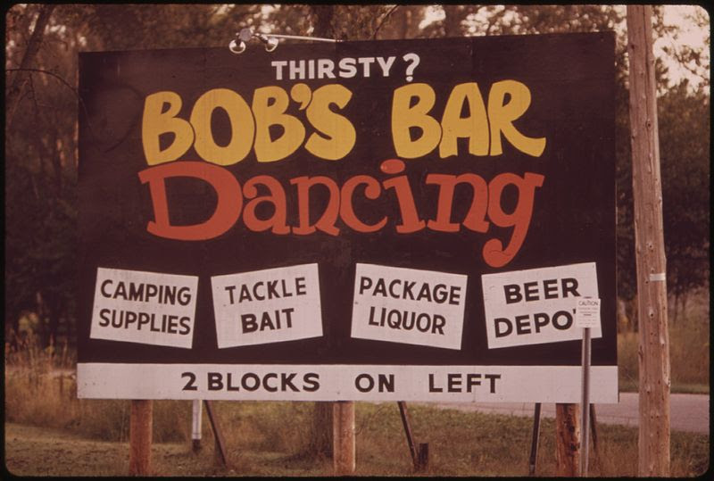
Near the town of Wisconsin Dells the Wisconsin River channels through deep, soft sandstone cliffs, cutting rock into fantastic shapes. These natural splendors have given rise to a booming tourist industry. People come in droves, often in campers and trailers. Boat trips, shops, bars, and diversions of every kind vie for patronage in an amusement complex extending 2 or 3 miles beyond the town: photo by Jonas Dovydenas (1939-) for the Environmental Protection Agency Project DOCUMERICA, September 1973 (US National Archives)

Near the town of Wisconsin Dells the Wisconsin River channels through deep, soft sandstone cliffs, cutting rock into fantastic shapes. These natural splendors have given rise to a booming tourist industry. People come in droves, often in campers and trailers. Boat trips, shops, bars, and diversions of every kind vie for patronage in an amusement complex extending 2 or 3 miles beyond the town: photo by Jonas Dovydenas (1939-) for the Environmental Protection Agency Project DOCUMERICA, September 1973 (US National Archives)

Near the town of Wisconsin Dells the Wisconsin River
channels through deep, soft sandstone cliffs, cutting rock into
fantastic shapes. These natural splendors have given rise to a booming
tourist industry. People come in droves, often in campers and trailers.
Boat trips, shops, bars, and diversions of every kind vie for patronage
in an amusement complex extending 2 or 3 miles beyond the town: photo by Jonas Dovydenas (1939-) for the Environmental Protection Agency Project DOCUMERICA, September 1973 (US National Archives)
Near the town of Wisconsin Dells the Wisconsin River channels through deep, soft sandstone cliffs, cutting rock into fantastic shapes. These natural splendors have given rise to a booming tourist industry. People come in droves, often in campers and trailers. Boat trips, shops, bars, and diversions of every kind vie for patronage in an amusement complex extending 2 or 3 miles beyond the town: photo by Jonas Dovydenas (1939-) for the Environmental Protection Agency Project DOCUMERICA, September 1973 (US National Archives)

Near the town of Wisconsin Dells the Wisconsin River channels through deep, soft sandstone cliffs, cutting rock into fantastic shapes. These natural splendors have given rise to a booming tourist industry. People come in droves, often in campers and trailers. Boat trips, shops, bars, and diversions of every kind vie for patronage in an amusement complex extending 2 or 3 miles beyond the town: photo by Jonas Dovydenas (1939-) for the Environmental Protection Agency Project DOCUMERICA, September 1973 (US National Archives)
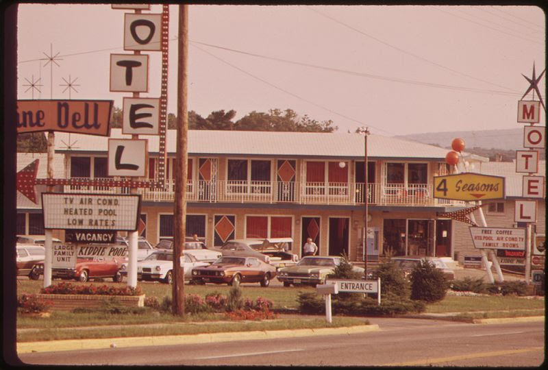
Near the town of Wisconsin Dells the Wisconsin River channels through deep, soft sandstone cliffs, cutting rock into fantastic shapes. These natural splendors have given rise to a booming tourist industry. People come in droves, often in campers and trailers. Boat trips, shops, bars, and diversions of every kind vie for patronage in an amusement complex extending 2 or 3 miles beyond the town: photo by Jonas Dovydenas (1939-) for the Environmental Protection Agency Project DOCUMERICA, September 1973 (US National Archives)

Near the town of Wisconsin Dells the Wisconsin River channels through deep, soft sandstone cliffs, cutting rock into fantastic shapes. These natural splendors have given rise to a booming tourist industry. People come in droves, often in campers and trailers. Boat trips, shops, bars, and diversions of every kind vie for patronage in an amusement complex extending 2 or 3 miles beyond the town: photo by Jonas Dovydenas (1939-) for the Environmental Protection Agency Project DOCUMERICA, September 1973 (US National Archives)

Near the town of Wisconsin Dells the Wisconsin River channels through deep, soft sandstone cliffs, cutting rock into fantastic shapes. These natural splendors have given rise to a booming tourist industry. People come in droves, often in campers and trailers. Boat trips, shops, bars, and diversions of every kind vie for patronage in an amusement complex extending 2 or 3 miles beyond the town: photo by Jonas Dovydenas (1939-) for the Environmental Protection Agency Project DOCUMERICA, September 1973 (US National Archives)
Near the town of Wisconsin Dells the Wisconsin River channels through deep, soft sandstone cliffs, cutting rock into fantastic shapes. These natural splendors have given rise to a booming tourist industry. People come in droves, often in campers and trailers. Boat trips, shops, bars, and diversions of every kind vie for patronage in an amusement complex extending 2 or 3 miles beyond the town: photo by Jonas Dovydenas (1939-) for the Environmental Protection Agency Project DOCUMERICA, September 1973 (US National Archives)
Boating on the Wisconsin River at Wisconsin Dells: photo by Jonas Dovydenas (1939-) for the Environmental Protection Agency Project DOCUMERICA, September 1973 (US National Archives)
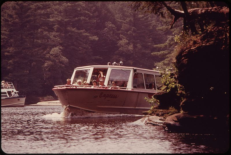
Boating on the Wisconsin River at Wisconsin Dells:: photo by Jonas Dovydenas (1939-) for the Environmental Protection Agency Project DOCUMERICA, September 1973 (US National Archives)

Near the town of Wisconsin Dells the Wisconsin River channels through deep, soft sandstone cliffs, cutting rock into fantastic shapes. These natural splendors have given rise to a booming tourist industry. People come in droves, often in campers and trailers. Boat trips, shops, bars, and diversions of every kind vie for patronage in an amusement complex extending 2 or 3 miles beyond the town: photo by Jonas Dovydenas (1939-) for the Environmental Protection Agency Project DOCUMERICA, September 1973 (US National Archives)

Near the town of Wisconsin Dells the Wisconsin River channels through deep, soft sandstone cliffs, cutting rock into fantastic shapes. These natural splendors have given rise to a booming tourist industry. People come in droves, often in campers and trailers. Boat trips, shops, bars, and diversions of every kind vie for patronage in an amusement complex extending 2 or 3 miles beyond the town: photo by Jonas Dovydenas (1939-) for the Environmental Protection Agency Project DOCUMERICA, September 1973 (US National Archives)

Near the town of Wisconsin Dells the Wisconsin River channels through deep, soft sandstone cliffs, cutting rock into fantastic shapes. These natural splendors have given rise to a booming tourist industry. People come in droves, often in campers and trailers. Boat trips, shops, bars, and diversions of every kind vie for patronage in an amusement complex extending 2 or 3 miles beyond the town: photo by Jonas Dovydenas (1939-) for the Environmental Protection Agency Project DOCUMERICA, September 1973 (US National Archives)

Near the town of Wisconsin Dells the Wisconsin River channels through deep, soft sandstone cliffs, cutting rock into fantastic shapes. These natural splendors have given rise to a booming tourist industry. People come in droves, often in campers and trailers. Boat trips, shops, bars, and diversions of every kind vie for patronage in an amusement complex extending 2 or 3 miles beyond the town: photo by Jonas Dovydenas (1939-) for the Environmental Protection Agency Project DOCUMERICA, September 1973 (US National Archives)

Near the town of Wisconsin Dells the Wisconsin River channels through deep, soft sandstone cliffs, cutting rock into fantastic shapes. These natural splendors have given rise to a booming tourist industry. People come in droves, often in campers and trailers. Boat trips, shops, bars, and diversions of every kind vie for patronage in an amusement complex extending 2 or 3 miles beyond the town: photo by Jonas Dovydenas (1939-) for the Environmental Protection Agency Project DOCUMERICA, September 1973 (US National Archives)
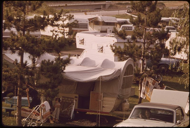
Near the town of Wisconsin Dells the Wisconsin River channels through deep, soft sandstone cliffs, cutting rock into fantastic shapes. These natural splendors have given rise to a booming tourist industry. People come in droves, often in campers and trailers. Boat trips, shops, bars, and diversions of every kind vie for patronage in an amusement complex extending 2 or 3 miles beyond the town: photo by Jonas Dovydenas (1939-) for the Environmental Protection Agency Project DOCUMERICA, September 1973 (US National Archives)
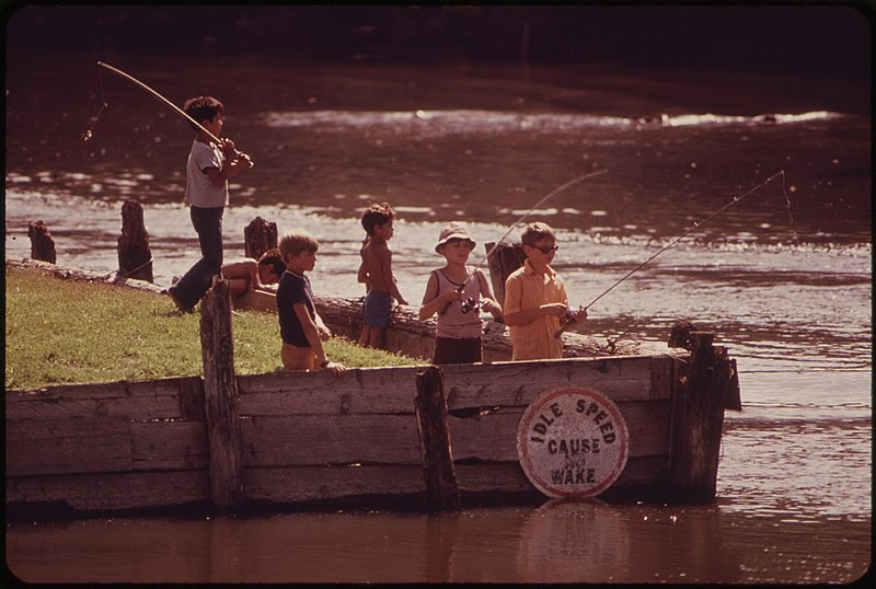
Youngsters fishing at Wisconsin Dells on the Wisconsin River: photo by Jonas Dovydenas (1939-) for the Environmental Protection Agency Project DOCUMERICA, September 1973 (US National Archives)
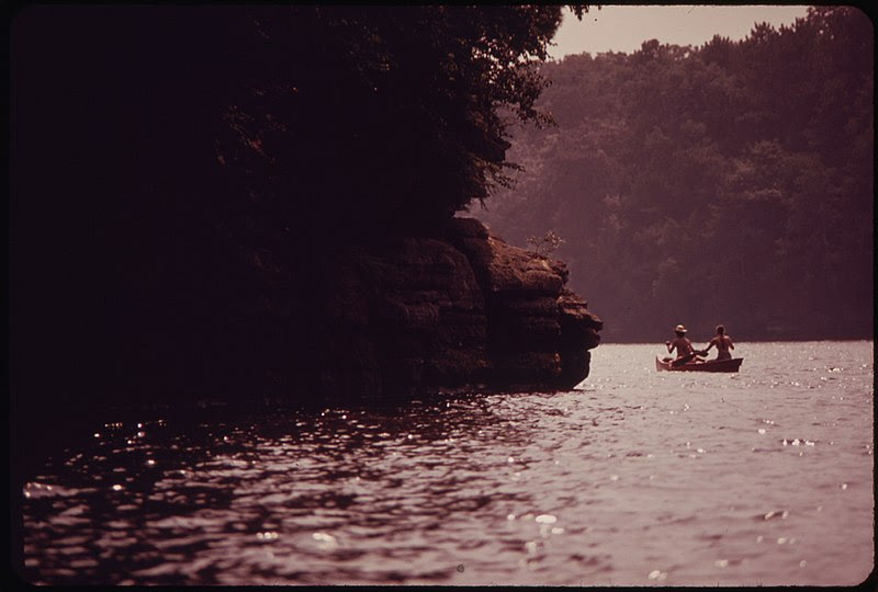
Canoeing on the Wisconsin River at Wisconsin Dells: photo by Jonas Dovydenas (1939-) for the Environmental Protection Agency Project DOCUMERICA, September 1973 (US National Archives)
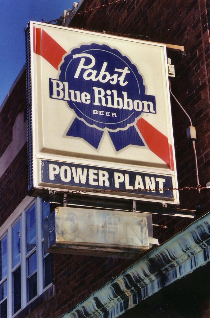
Pabst Blue Ribbon sign, Milwaukee, Wisconsin: photo by RickM2007, 27 September 2006




4 comments:
Tom,
All condensation points to Panama. And not that I'm complaining, but didn't we all know. What a haunting poem that is. "Learned to sit at a desk and condense". We'll soon be left to eat those very desks, the greed of man built, and his perversity justified.
manik,
We all knew. And they all knew that we knew. And we know that...
And they still think we owe everything to them.
And we think the fifth photo here owes everything to you.
Tom,
Thanks for these "early signs" glimpses in pictures and words, Niedecker's "life by water" included ("b. Fort Atkinson, Wisconsin, 1903 d. Fort Atkinson, Wisconsin, 1970"), brings to mind this one --
Old Mother turns blue and from us,
"Don't let my head drop to the earth.
I'm blind and deaf." Death from the heart,
a thimble in her purse.
"It's a long day since last night.
Give me space. I need
floors. Wash the floors, Lorine!--
wash clothes! Weed!"
Thanks very much, Steve, for bringing that Niedecker classic.
I think it helps with any poet as sensitive to, indeed as determined by, the hard facts of geography and social class, to see what their living and working environment looked like -- particularly in the case of any poet associated in academic classification with any "ism" (in this case, of course, "Modernism"), a form of categorizing which tends to remove the poet and the work from the realities and circumstances of production, to some ideal space in which no living thing ever was or will be...
Post a Comment